New assessment: Increased risk of eruption at Grindavík without warning
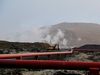
The eruption started last night near Sundhnúkagígar crater row. mbl.is/Árni Sæberg
The Icelandic Met Office has issued a new hazard assessment map for the eruption at Sund-hnúkagígar crater row. The map is based on interpretation of the latest data and the status of the activity in the eruption.
It is stated that the risk has increased significantly in all areas defined in the previous hazard assessment map, namely in areas 1 to 4.
Two new areas have been added to the map, areas 5 to 6. The Icelandic Meteorological Office states that this map will be valid until Thursday, December 28.
The last hazard assessment map was issued on December 8 and can be seen below the new map for clarity of the changes.
It can be seen that there is an increased risk of unannounced eruption in Grindavík and also that eruption is considered possible at Svartsengi and the Blue Lagoon, in area 1 on the map.
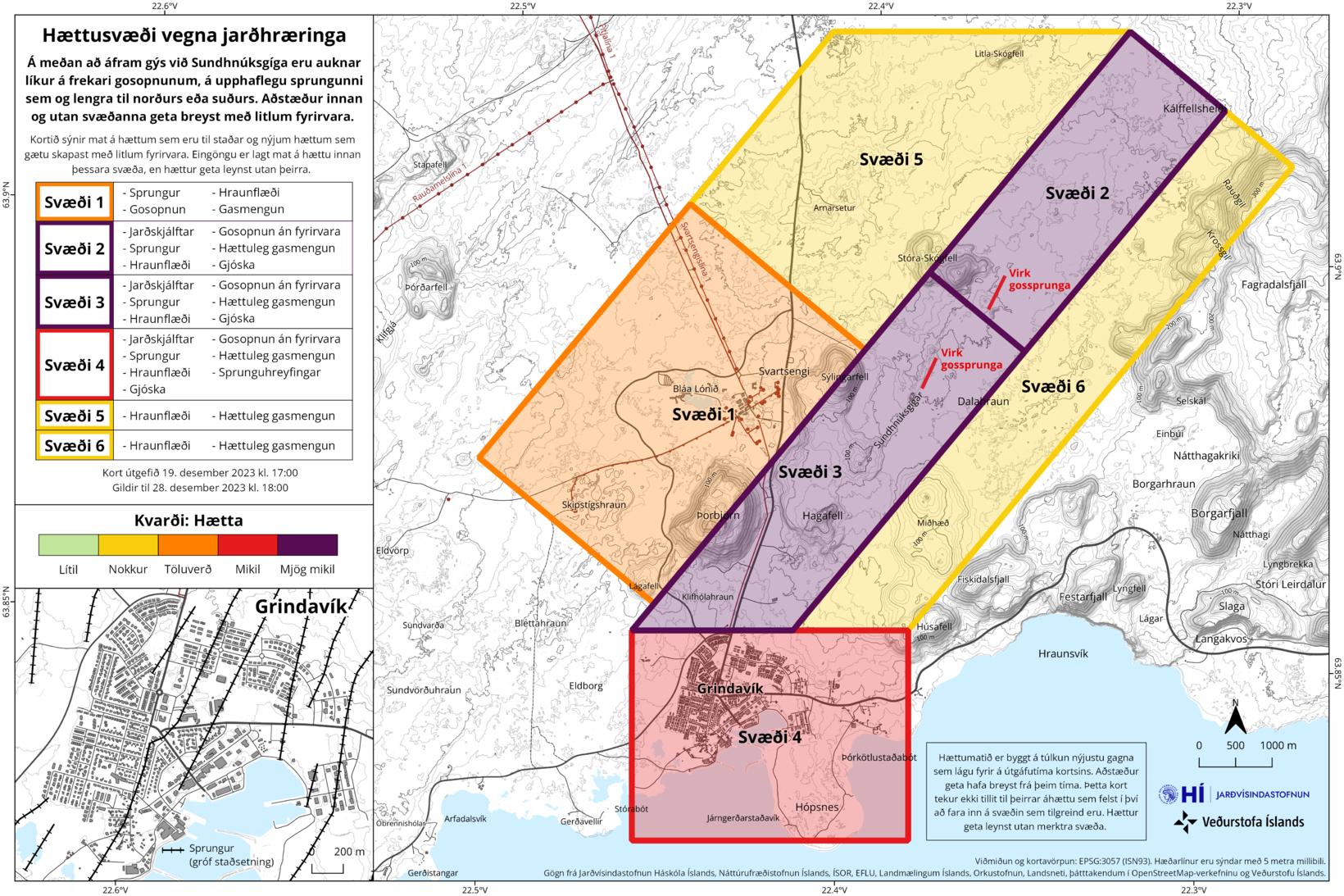
This is the new hazard assessment map issued today on December 19. Kort/Veðurstofa Íslands
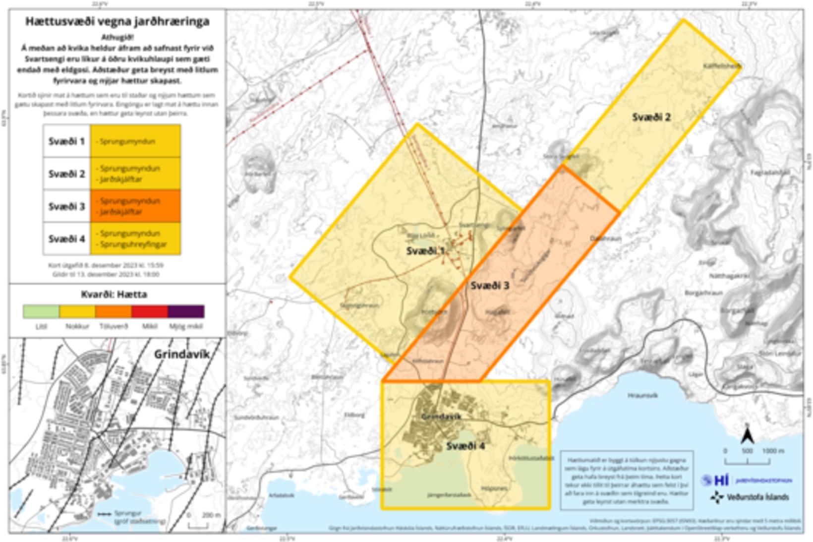
This is the older hazard assessment map issued on December 8. map/Icelandic Met Office
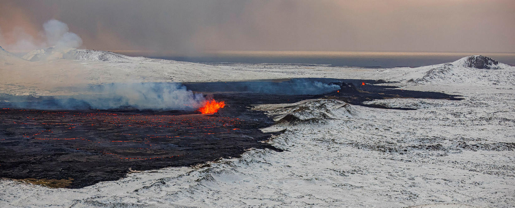
Tongue of lave reaching west
It is noted that the intensity of the eruption continues to decrease.
“On new photos of the area it is now visible that the eruption is now coming from three eruption areas, southeast of Stóra-Skógfell are now erupting, down from five eruption areas before. Lava has flowed mostly eastwards from the volcanoes, but there is also a tongue of lava reaching the the west, north of Stóra-Skógafell.”
Since the eruption began, about 320 earthquakes have been detected over magma dike.
The largest earthquake measured magnitude 3.1 at 23.25 last night. After midnight, the seismic activity has decreased considerably and since 12 am today, only 10 earthquakes have been measured.
The warning may be very short
It is pointed out that there is an increased likelihood of eruption fissures opening up more widely, during the eruption, on the original fissure as well as further north or south.
“If you look at the events leading up to the eruption, it took about 90 minutes from the first signs to the beginning of the eruption. Given the beginning of the eruption at Sundhnúkur crater row, the notice of new openings can therefore be very short.”