Severe Gale, Blizzard and Impassable Roads Expected
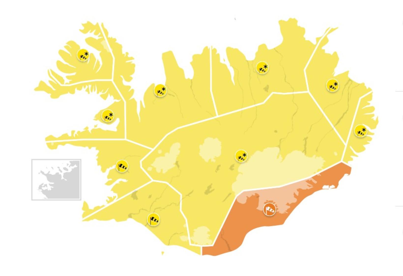
Map/Icelandic Met Office
The Icelandic Met Office has issued weather alerts for the whole country. For Southeast Iceland, an orange warning will be in effect from 4 pm today until noon Friday. A north and northwest severe gale or storm is forecast with wind gusts in excess of 45 m/sec and the possibility of a sandstorm and flying pebbles.
For the rest of the country, the warnings are yellow, already in effect for West Iceland, the West Fjords and Northwest Iceland, but effective from noon today in Northeast Iceland, from 2 pm in East Iceland, and from 6 pm in the East fjords.
A north severe gale or storm is expected in all the areas. In Breiðafjörður, West Iceland, and in the West Fjords, these will be accompanied by show showers, resulting in poor visibility and difficult driving conditions. Roads may even become impassable.
In Northwest and Northeast Iceland, in the eastern coastal areas and the East Fjords, even more snow is expected, along with the gale. There will be poor visibility, and roads may become impassible. A north blizzard is forecast for the Highlands as well.
The warnings are in effect through midnight tomorrow in some areas and through noon Friday in others. For more detail, see en.vedur.is.
Always check the forecast before traveling and look up road conditions on safetravel.is and on road.is.


/frimg/1/57/87/1578747.jpg)