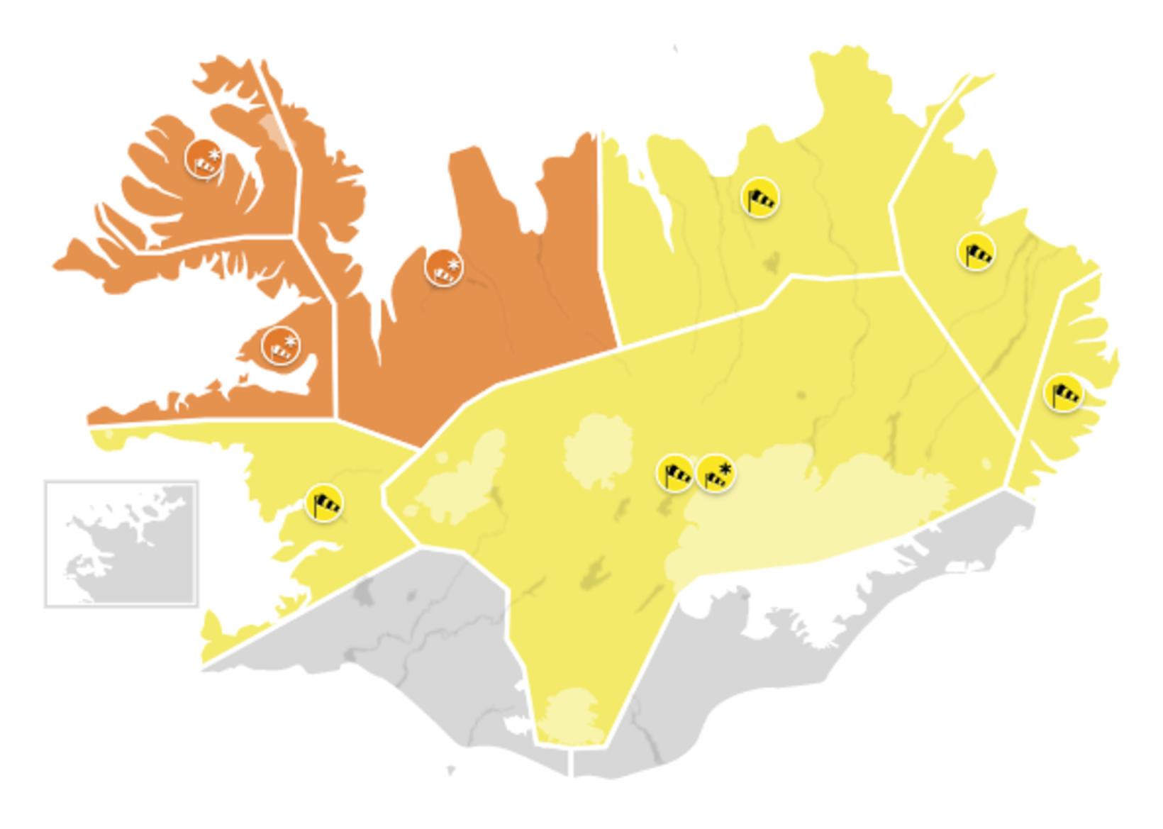
Severe Gale or Storm Forecast for Most of Iceland
Map/Icelandic Met Office
The Icelandic Met Office has issued weather warnings for most of Iceland today and this evening. The only areas not affected are the capital area and the southernmost part of the country.
A yellow alert takes effect in the Breiðafjörður bay area, West Iceland, at 11 am, and in the West Fjords and Northwest Iceland at noon, with a southwestern gale or severe gale, accompanied by snow showers. Driving conditions will deteriorate, making traveling hazardous. The weather will move into the northeast by 2 am, with wind gusts in excess of 40 m/sec.
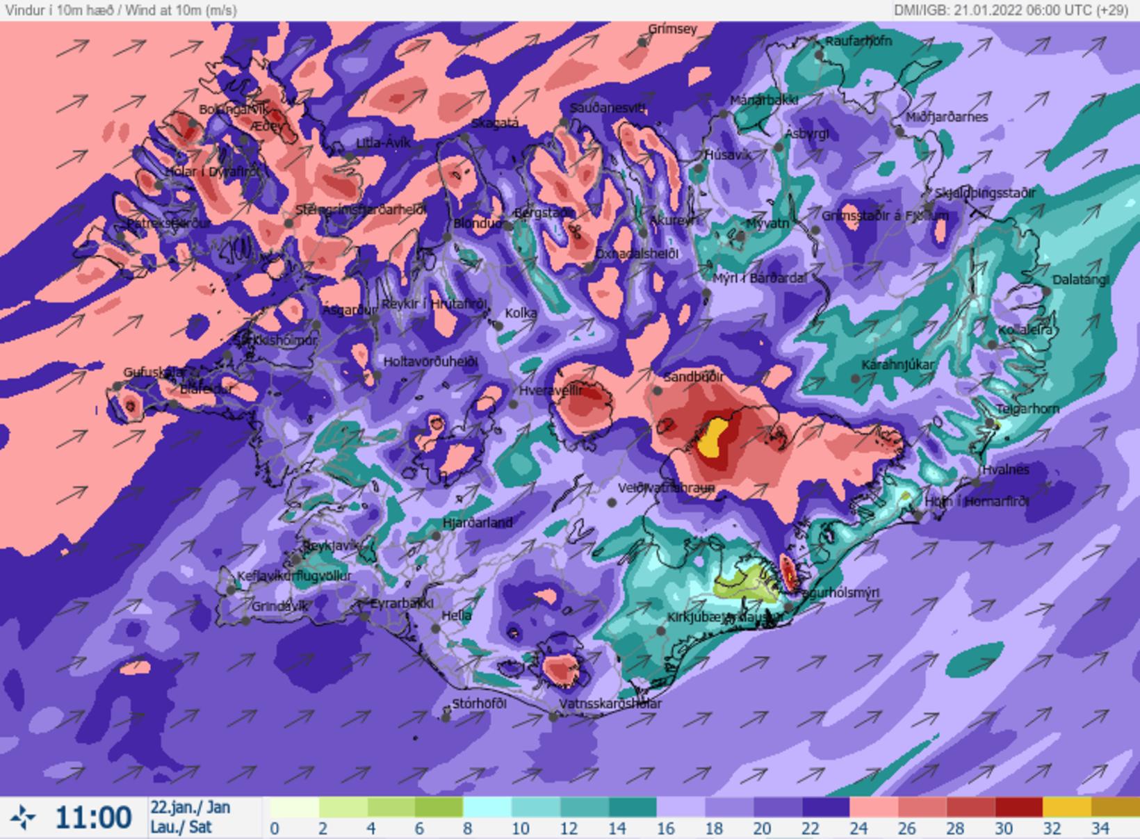
The wind speed forecast for 11 am tomorrow. Map/Icelandic Met Office
The worst weather will affect the Breiðafjörður bay area in West Iceland, the West Fjords, and Northwest Iceland, where an orange weather warning will be in effect from 6 or 7 pm. It will remain in effect for Breiðafjörður until 3 pm tomorrow, and until 6 pm tomorrow for the West Fjords and the Northwest.
In those areas, a southwesterly severe gale or storm is forecast with wind gusts in excess of 40 m/s. Snow or sleet, and later snow showers, is expected with poor visibility and deteriorating driving conditions. Traveling is not advised. In the West Fjords, considerable snowfall is expected.
For a detailed forecast, visit vedur.is .


/frimg/1/57/87/1578747.jpg)