
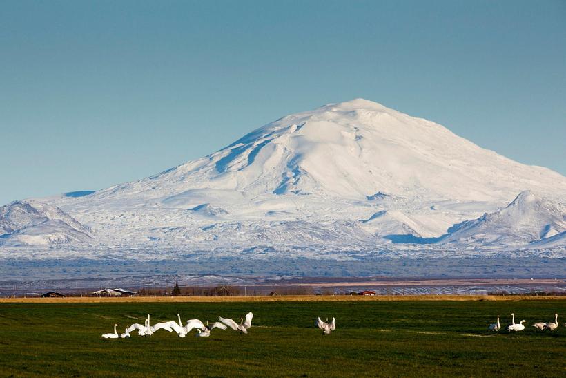
Earthquakes South of Hekla Volcano
Hekla vocano. mbl.is/Helgi Bjarnason
More than 320 tremors have registered in the vicinity of Hekla volcano, South Iceland, since shortly before noon yesterday, more than 150 of them since 6 pm last night, mbl.is reports.
The largest earthquake was of magnitude 5.2. It hit the area at 1:21 pm yesterday. Its source was by Vatnafjöll mountains, about 7.5 km south of Hekla volcano. It was widely felt in South Iceland, as well as in the capital area. The largest aftershocks measured 2.7 in magnitude.
According to the Icelandic Met Office, the M5.2 earthquake occurred on the easternmost side of the 70-km-long South Iceland fracture zone, which extends from Hengill mountain in the west to Vatnafjöll mountains in the east. Geophysicist Magnús Tumi Guðmundsson tells mbl.is there is no reason to think there is a connection between the seismic activity and a potential eruption in Hekla.
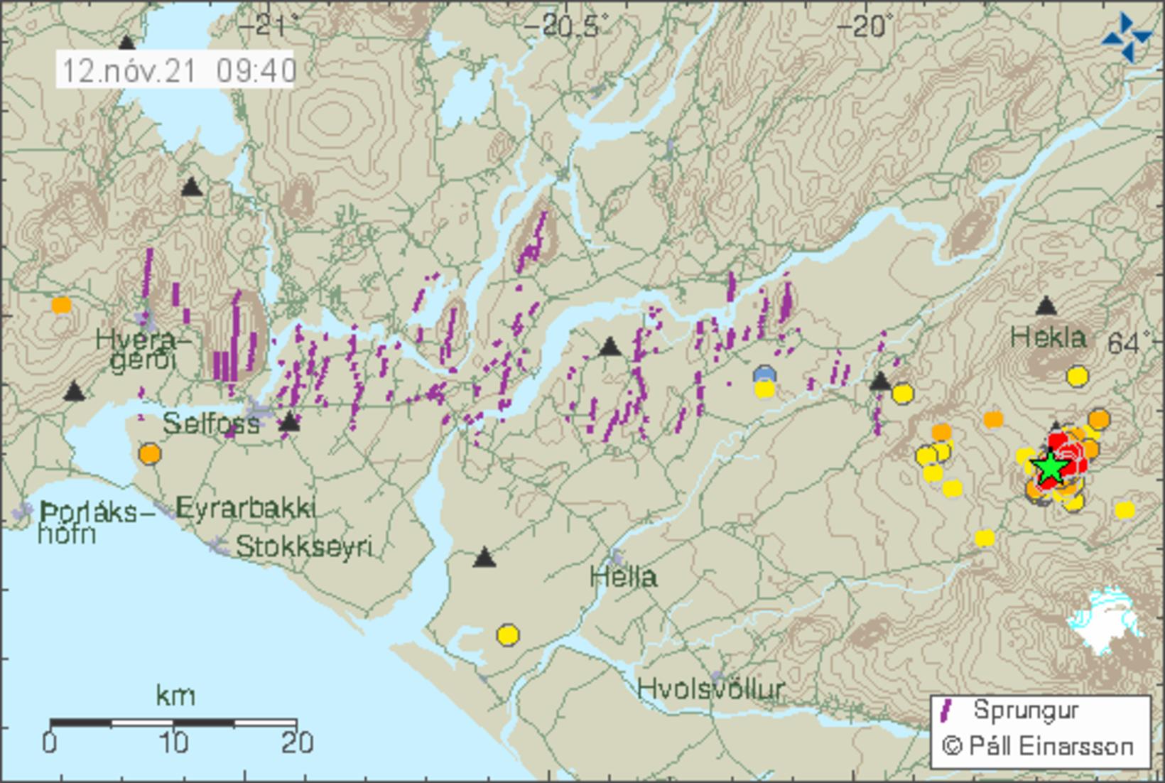
The green star shows the location of the seismic activity. Map/Icelandic Met Office
“Initial indications suggest there is much more likely a connection between this and movements in the South Iceland fracture zone, where Iceland’s largest earthquakes occur, where the tectonic plates are moving against each other, creating friction,” Magnús states. As they rub against each other, earthquakes occur.
He notes that the last earthquake to occur near Vatnafjöll mountains hit in 1987 and was of magnitude 5.9. “Considerably larger, but in a similar location,” he continues. “Then you have the aftershocks that follow.” They are typical, he states, when the surrounding area is recovering from a quake.
Hekla erupted in 1991, four years after the aforementioned earthquake, then again in 2000, but has not erupted since.
The Icelandic Met Office is closely monitoring the area. You can follow seismic activity on vedur.is .


/frimg/1/48/27/1482789.jpg)