New map shows position of the eruption
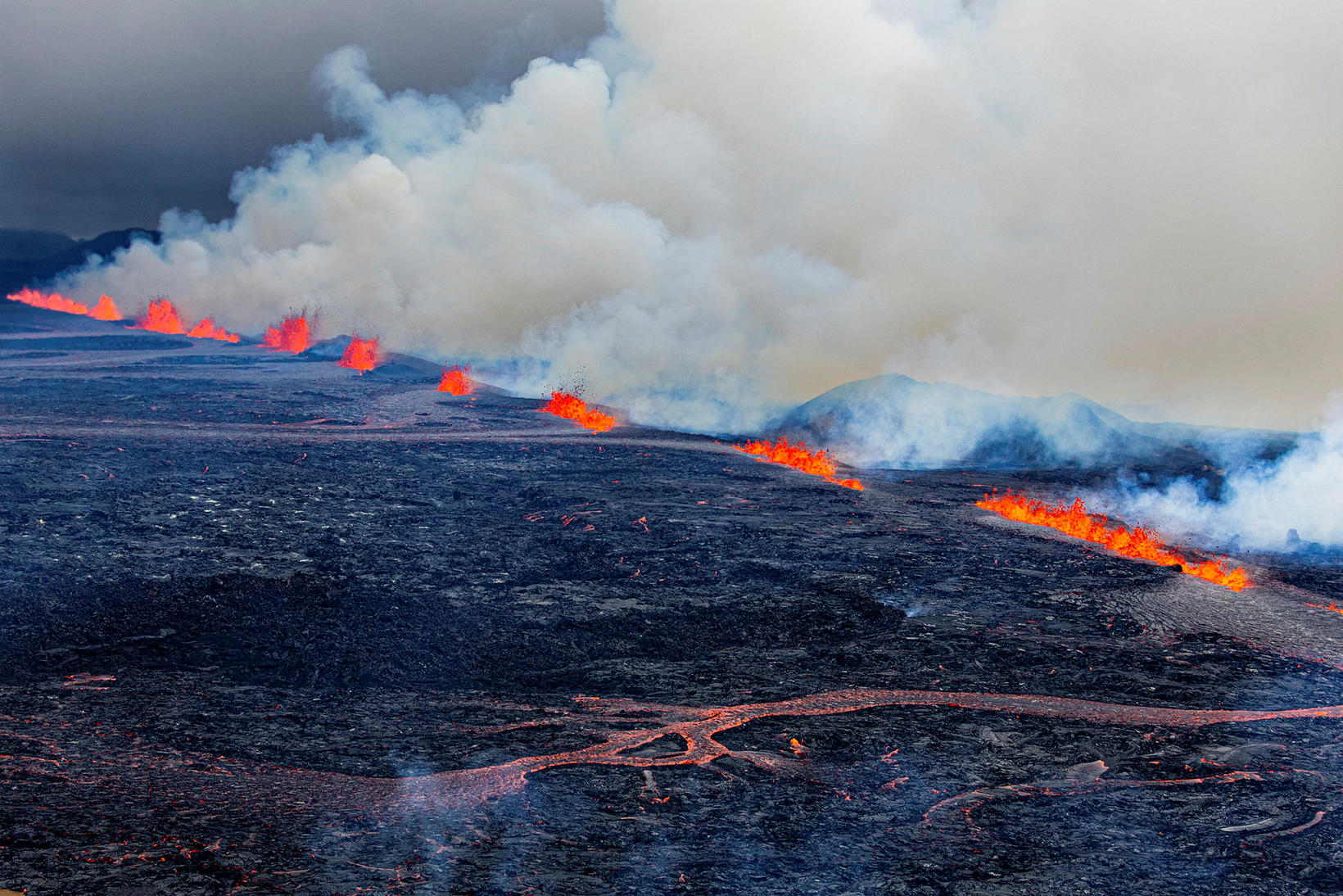
View over the eruption sites yesterday. mbl.is/Árni Sæberg
A new map by Morgunblaðið and mbl.is illustrates the location of the volcanic eruption on the Sundhnúkur crater row — the twelfth eruption on the Reykjanes Peninsula since March 2021, and the ninth in or near Mt Sundhnúkur since December 2023.
The map shows that the fissure, which opened just before 4 a.m. on Wednesday morning, runs northeast for about 2.5 kilometers east of Hagafell, over older lava from previous Mt Sundhnúkur eruptions.
Lava has partly flowed over this older lava field but has also spread beyond it to the east and north.
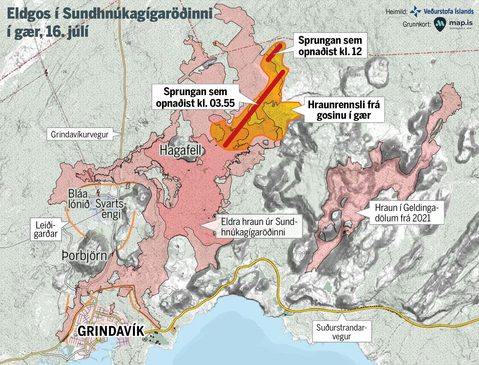
The red lines indicate the eruption fissures. The longer line marks the fissure that opened at 3:55 a.m. the night before last, while the shorter line marks the fissure that opened at noon yesterday. The orange area shows the lava flow from yesterday's eruption. map/mbl.is
Eruption sites far from Grindavík
The fissure that opened around noon yesterday lies northeast of Mt Hagafell as well, also trending northeast, but is slightly west of the larger fissure. It could be said to continue from the main fissure, shifted slightly to the west.
The image also shows that the eruption sites are considerably far from the town of Grindavík.
Eruption activity continues at Sundhnúkur, now concentrated in several craters near the middle and northern ends of the fissure.
Access to Grindavík has been reopened for residents, but tourists and the general public are still not allowed to enter the town at this time.