June begins with wintry weather
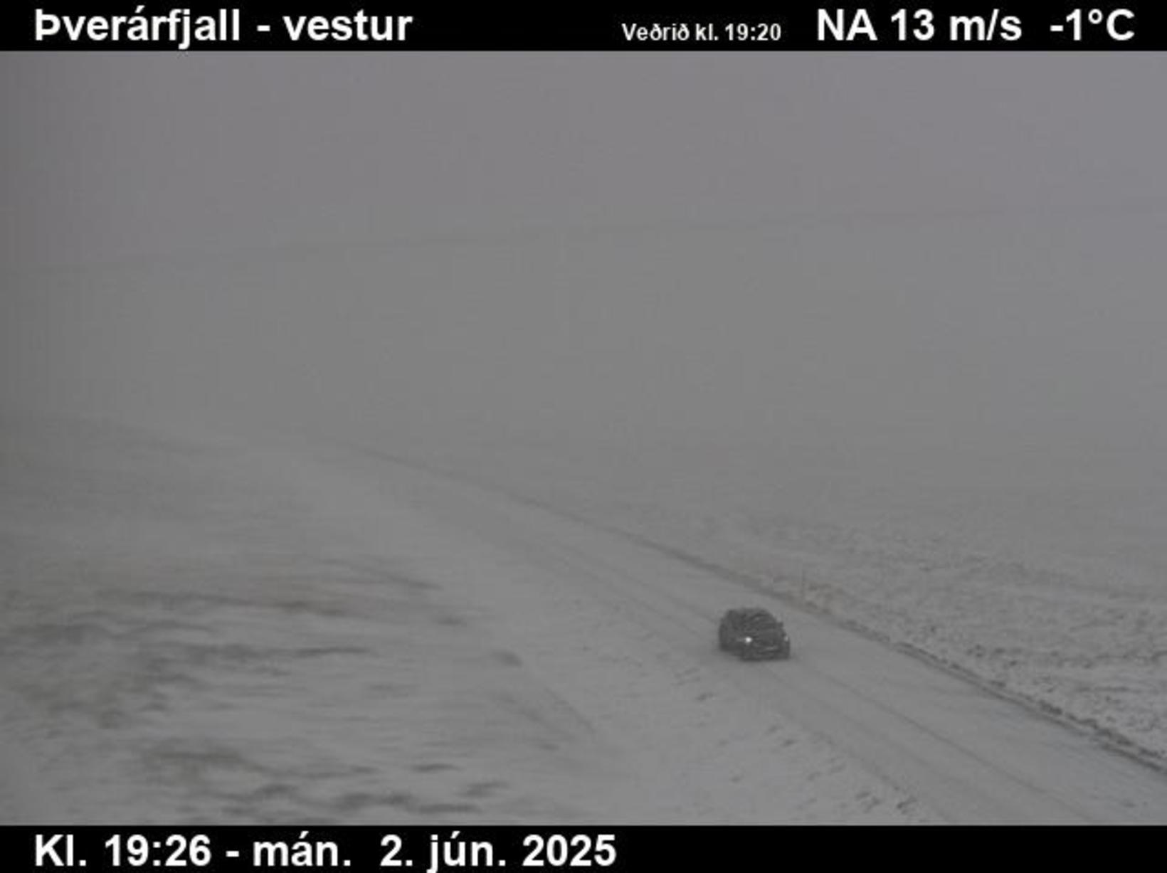
Visibility at Mt Þverárfjall is at its worst. Screenshot/IRCA
After an unusually warm May, June has taken a sharp turn, bringing winter-like conditions to much of Iceland. Snow, strong winds, and poor visibility have prompted weather warnings across the country, and authorities are urging caution — especially for those traveling through mountainous areas.
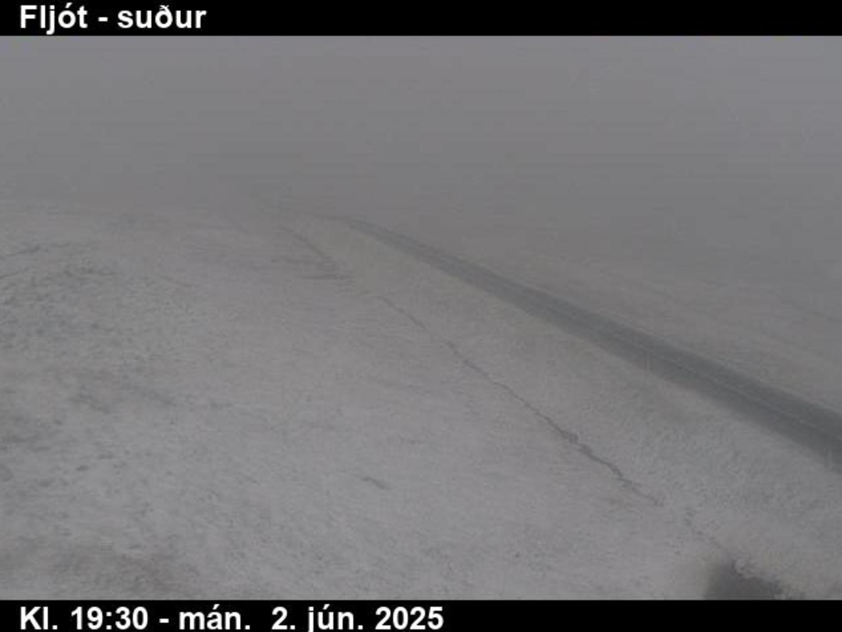
As seen in accompanying photos from Þverárfjall and Fljót, the weather is far from what one might expect in early June.
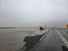
A blinding storm was at Siglufjörður Road last night. Screenshot/IRCA
Visibility deteriorating, warnings in effect
Visibility has already dropped significantly on many roads and is expected to worsen. The National Commissioner of Police, in coordination with police departments across Northwestern, Northeastern, Eastern, and Southern Iceland, has declared a public safety uncertainty phase as of 10:00 a.m. yesterday evening. The decision follows forecasts of strong northerly winds set to persist over the next 24 hours.
“Strong winds with powerful gusts are expected from the north, creating hazardous conditions for vehicles, especially those vulnerable to wind,” the statement warns. “In some areas, snow and drifting snow are forecast, leading to severely reduced driving conditions and possible road closures — particularly on mountain routes. Vehicles not equipped for winter driving may struggle, and travel to mountainous areas is strongly discouraged until the weather passes.”
The statement also notes the possibility of flooding and landslides in the northern regions due to the changing weather.
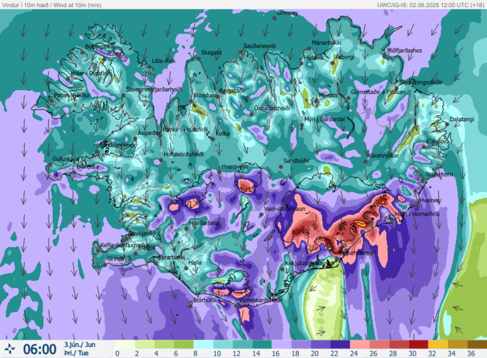
Here is the wind forecast at 6 o'clock this morning. Map/The Icelandic Met Office
Snow in lowlands, rain to follow
According to meteorologist Birgir Örn Höskuldsson from the Icelandic Meteorological Office, the conditions, though dramatic, are not unexpected.
“It’s starting to snow heavily,” Höskuldsson said last night. “It’s snowing in Fljót, which is in a lowland area on the Tröllaskagi Peninsula. The road in Ólafsfjörður is turning gray with snow, and there’s been considerable accumulation on Öxnadalsheiði. This is all in line with our forecasts.”
The wintry weather is expected to continue through the night and into tomorrow morning.
“The coldest air mass will arrive tonight and linger into the morning,” he added. “By tomorrow, precipitation will gradually shift to rain, although the weather will remain gloomy. As temperatures rise, wind speeds are likely to increase, and the combination of rain on top of fresh snow may cause further complications.”