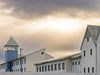
Hafnarfjörður in 3D
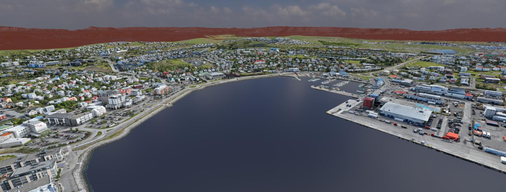
A photo taken of Haraldsson's 3D model of Hafnarfjörður. Photo/Ólafur Haraldsson
Ólafur Haraldsson, CEO of Designing Reality, has created a 3D model of Hafnarfjörður.
The model is made from 200,000 drone images and 4 trillion pixels.
Haraldsson has extensive experience in creating 3D models from photographs. He started in the film industry, where he created backgrounds for films and television series, among other things, before moving into engineering.
Demonstrated the possibility
Haraldsson has strongly advocated for such 3D models to be made for the country's urban areas. However, the response has always been that this is not possible. It would take too long and it is simply not possible to fly the drone as far as it would be necessary to cover entire towns.
The proximity to Reykjavík Airport is also an obstacle to such a project due to certain flight regulations that must be followed. For example, the drone has to be flown considerably lower than is ideal.
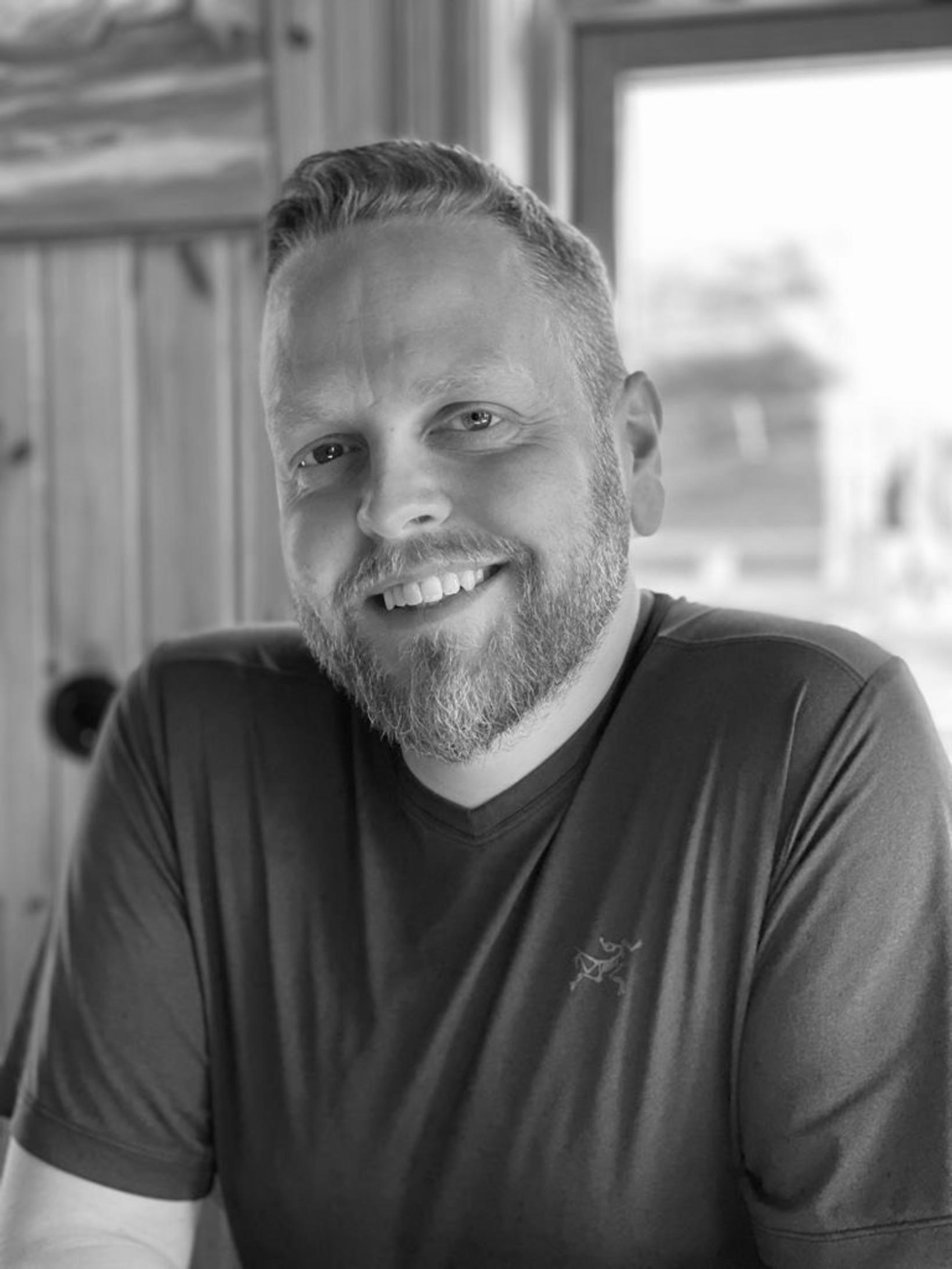
Ólafur Haraldsson. Photo/Sent to mbl.is
“I had to fly below the limit, really low, which means I had to take more pictures,” Haraldsson says in an interview with mbl. He says the flying altitude has worked out well in the end, “Because I had to fly so low, I got an extremely high resolution, 1.25 cm, which is far above what is needed,”
When asked, he says Hafnarfjörður was chosen because of the town’s size and proximity to Reykjavík Airport. Haraldsson’s project therefore gives his idea proof of concept, but it was important to him to show that this was possible despite the proximity to the airport.
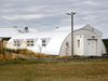
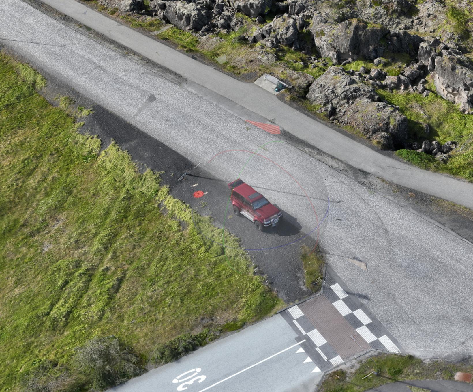
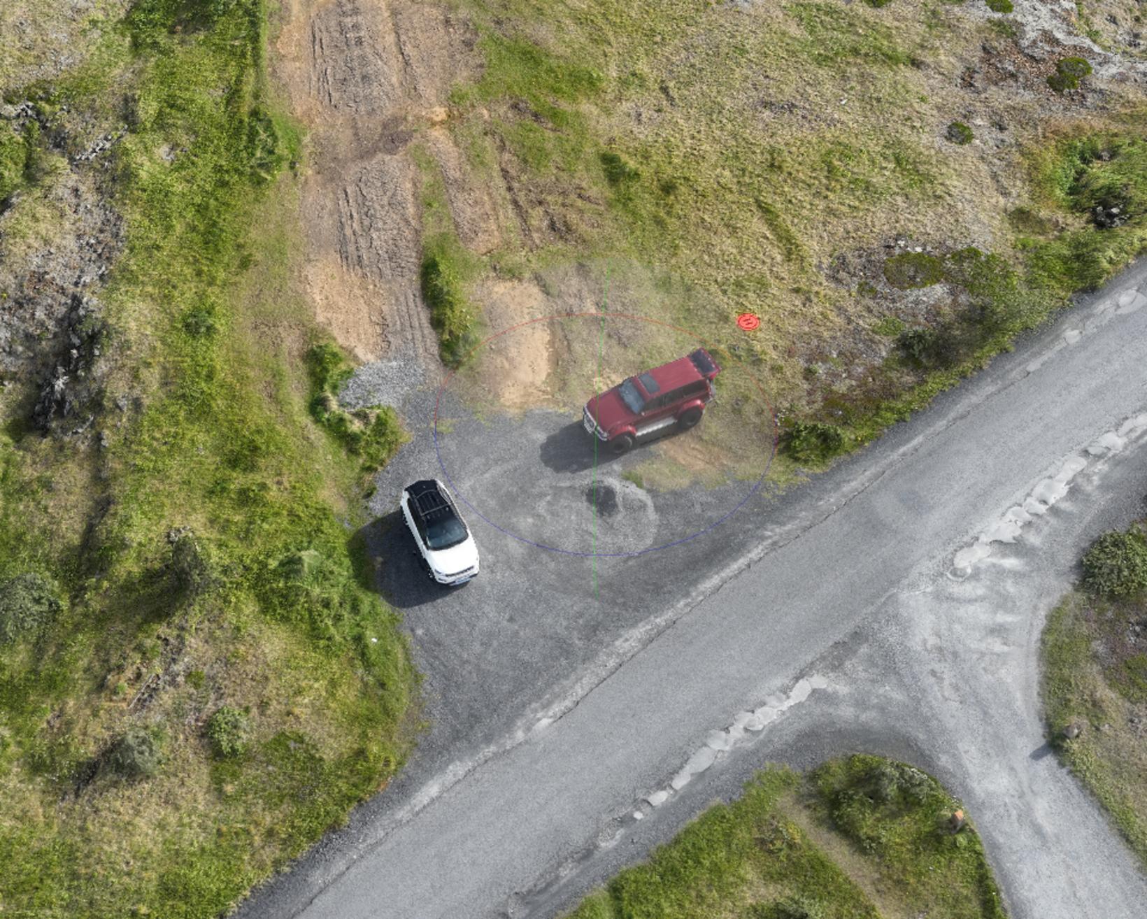
Where is Óli?
During the photo shoot, Haraldsson (Óli) was on the move around Hafnarfjörður, and his car, a red Land Cruiser, along with a drone landing pad (orange circle) can be found in about 20 places in the model .
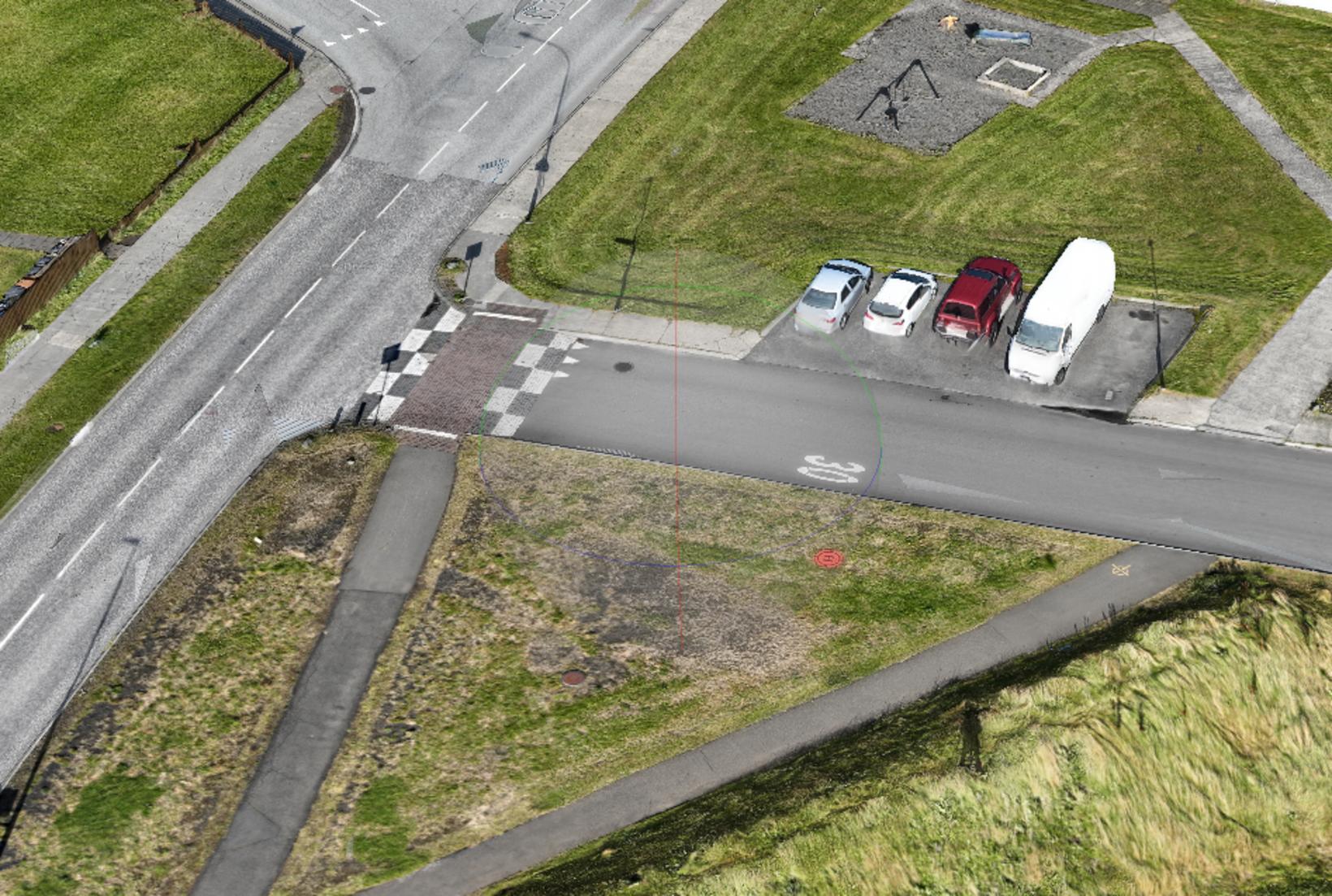
Where is Óli? Photo/Ólafur Haraldsson
Where is Óli? Photo/Ólafur Haraldsson
Where is Óli? Photo/Ólafur Haraldsson
Future possibilities
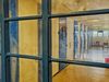
It is generally customary today to use orthographic images when creating aerial map bases, but then the images are in two dimensions and taken from an airplane. The image itself is then projected down and only the sides of the houses are visible on the flat image.
Haraldsson's project, however, falls under what is called true orthographic, where the images are taken with drones and projected onto a three-dimensional model. This, he says, is the future for urban areas.
The model of Hafnarfjörður demonstrates the possibilities that this offers. The data can, for example, be used in surveys, webcams, and planning.
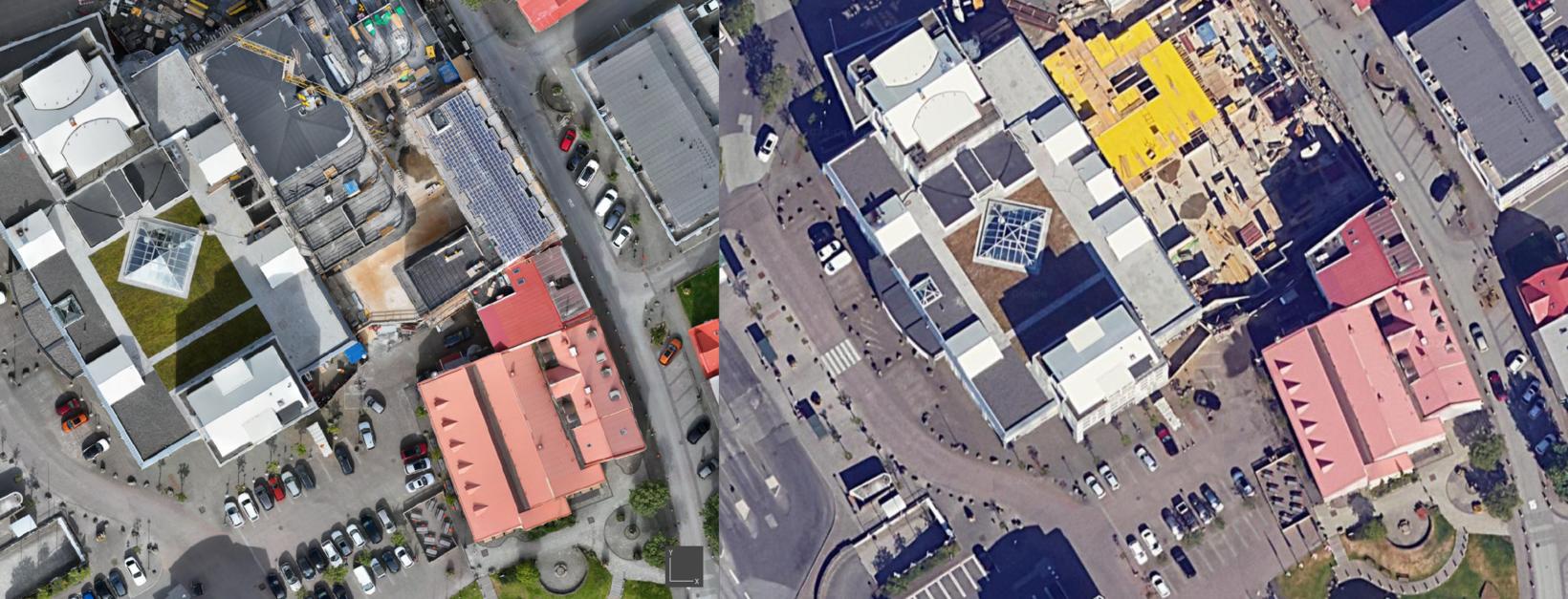
Here you can see the difference between "True Ortho" and "Ortho". Photo/Ólafur Haraldsson
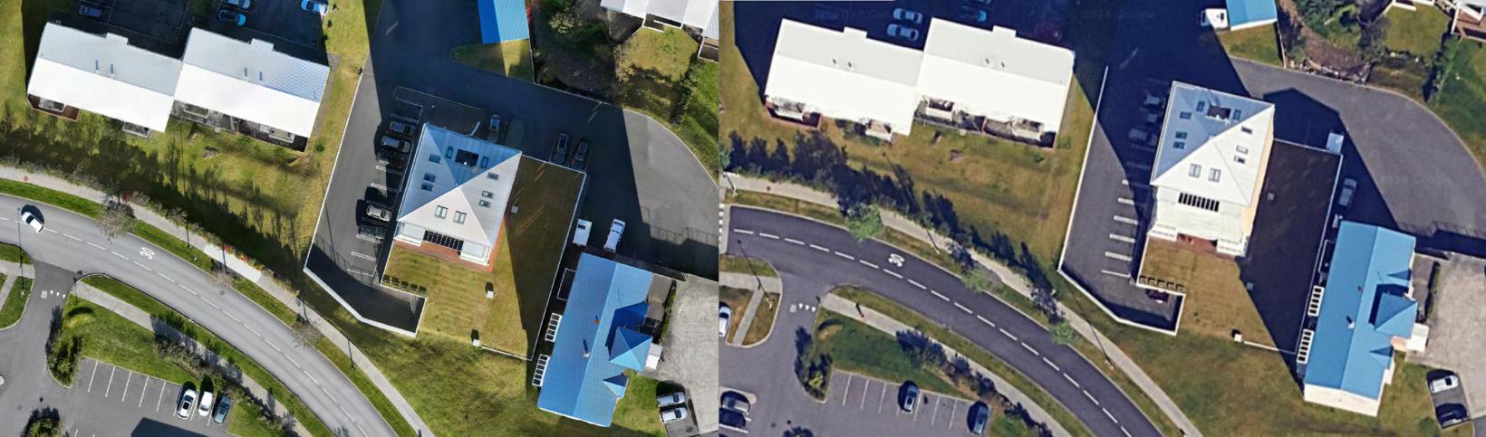
Here you can see the difference between "True Ortho" and "Ortho". Photo/Ólafur Haraldsson
Not subject to size limits
Haraldsson says that such projects are not subject to size limits. “I designed it so that I just broke it down, it’s like eating an elephant. That’s why I could have had five drones at once and it would have been almost five times faster,”
He says the same applies to the post-processing of the data. It’s just about the number of computers.
He says that such projects have not been done this way before, but his theory is that “it doesn’t matter how big the area is and how many images,”.
See more on Haraldsson's website .
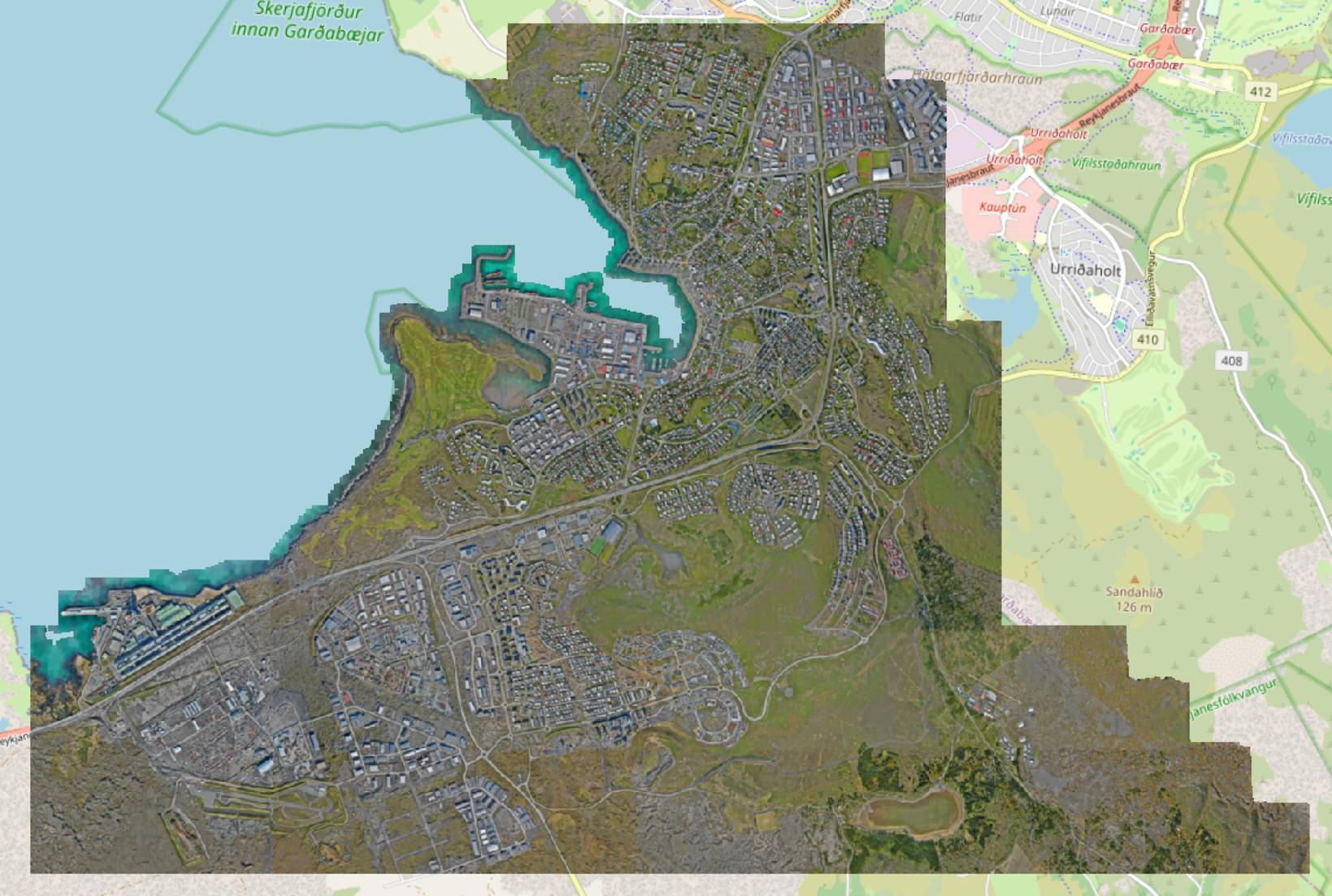
„True Ortho image of the whole of Hafnarfjörður. Photo/Ólafur Haraldsson