Yellow warnings come into effect
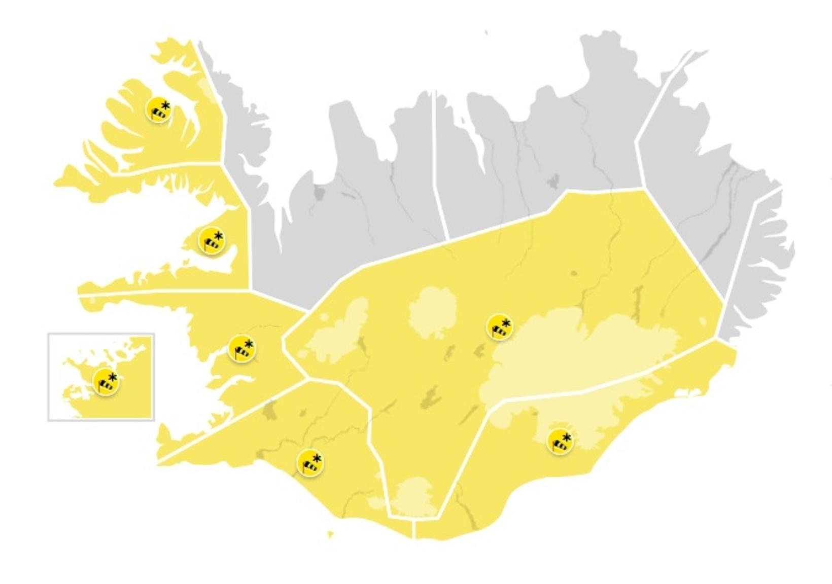
Gular viðvaranir taka gildi víða um land síðar í dag. Kort/Veðurstofa Íslands
Yellow warnings come into effect across the country today or tonight, including in the capital area, South Iceland, the Westfjords, and in Breiðafjörður. Snowfall and poor driving conditions can be expected. Traffic could be disrupted, especially on mountain roads.
The forecast is for a growing southeasterly wind today and it will start to snow in the southwest in the afternoon. There will be a gale or storm tonight and snowfall or rain in the south and west of the country.
Much slower winds will be across the country in the northeast, dry and quite frosty. The weather will go down in West Iceland tonight.
Southeasterly 10-15 m/s winds and rain or sleet will be east until tomorrow afternoon. Light winds will be elsewhere and scattered showers or sleet, with temperatures around freezing. Southwesterly 5-13 m/s wind will be late tomorrow and it will brighten up in the northeast of the country.
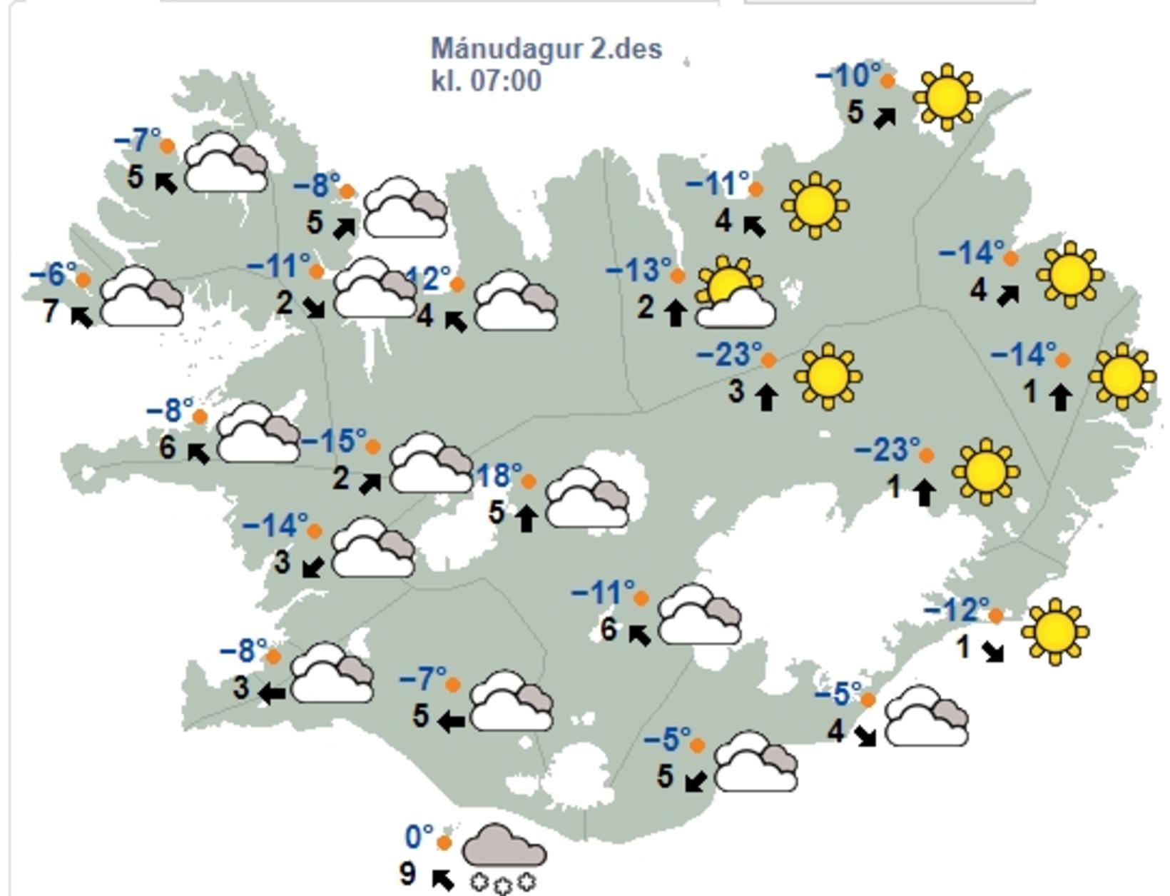
Weather map from the Icelandic Meteorological Office at 7 am this morning. Map/The Icelandic Met Office
Temperatures below 20 degrees C in many places overnight
There was severe cold in many places throughout the country last night and early this morning, and the lowest temperature was minus 24.3 degrees Celsius in Svartárkot in Bárðardalur Valley. In Möðrudalur Valley, the temperature dropped to minus 24 degrees Celsius, at Dettifoss Waterfall the lowest temperature was minus 22.7 degrees Celsius, and at Grímsstaðir á Fjöllum it was minus 22.5 degrees Celsius.
In Reykjavík, the temperature was minus 12 degrees Celsius overnight. As the day goes on, the country will warm up with a growing southeasterly wind from the southwest, but the wind will be slower in the north, and there will still be considerable frost.


/frimg/1/53/30/1533092.jpg)