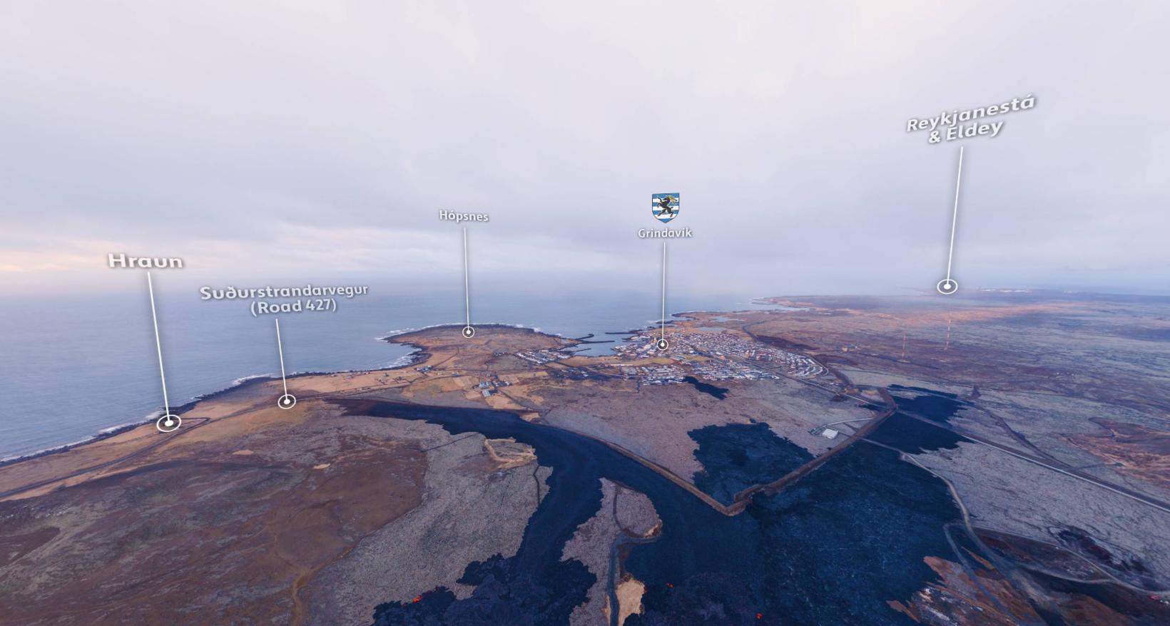
360 degree panoramic photos show the proximity to the infrastructure
Hörður kveðst vera farinn að þekkja öll örnefnin í nágrenninu. mbl.is/Hörður Kristleifsson
Now the new landscape at the Sundhnúkagígar crater row, Svartsengi, and Grindavík can be observed in 360-degree panoramic photographs compiled by photographer Hörður Kristleifsson.
The two pictures show the new lava field and how the lava flowed along the defense walls and was located close to Suðurstrandarvegur road.
“They’re a combination of 25 drone-type images in one ball,” Kristleifsson explains to a reporter when called and asked about the making of the overview-type images.
You can view the photographs below.
Knows the place names by heart
You can also find the various place names, which many might have been wondering about the location of when reading news articles in the past weeks and months.
“I’ve been making these kinds of pictures for so long, I know these place names by heart.”
The second overview image was taken yesterday at sunrise, not far from Hagafell.
The other overview was taken on March 17 over the fissure. It shows how the lava flowed over Grindavíkurvegur road towards the power plant and the Blue Lagoon in Svartsengi.
Photo taken March 20, 2024:
Photo taken March 17, 2024:


/frimg/1/38/77/1387784.jpg)