Threat of civil protection declared

mbl.is
A threat level of civil protection has been declared due to an intense seismic swarm at Sundhnúkar crater row, north of Grindavík.
This is stated in an announcement from the National Commissioner of the Police, who said that the declaration is in consultation with the Commissioner of the Police in Suðurnes in the Reykjanes peninsula.
Earthquakes could be larger and volcanic eruption could occur
“Earthquakes can be larger than the ones that have occurred and this scenario could lead to a volcanic eruption. However, there are no signs yet that magma is moving to the surface. Progress is being closely monitored,” the statement reads.
Furthermore, residents are encouraged to follow up on all information on the Civil Protection website, almannavarnir.is, as well as the websites of the Icelandic Met Office and the media.
The threat level of civil protection is described as the risk is increasing and that measures are taken to ensure the best possible safety of those who live/dwell in the area. This is done by strengthening preparedness in the area concerned.
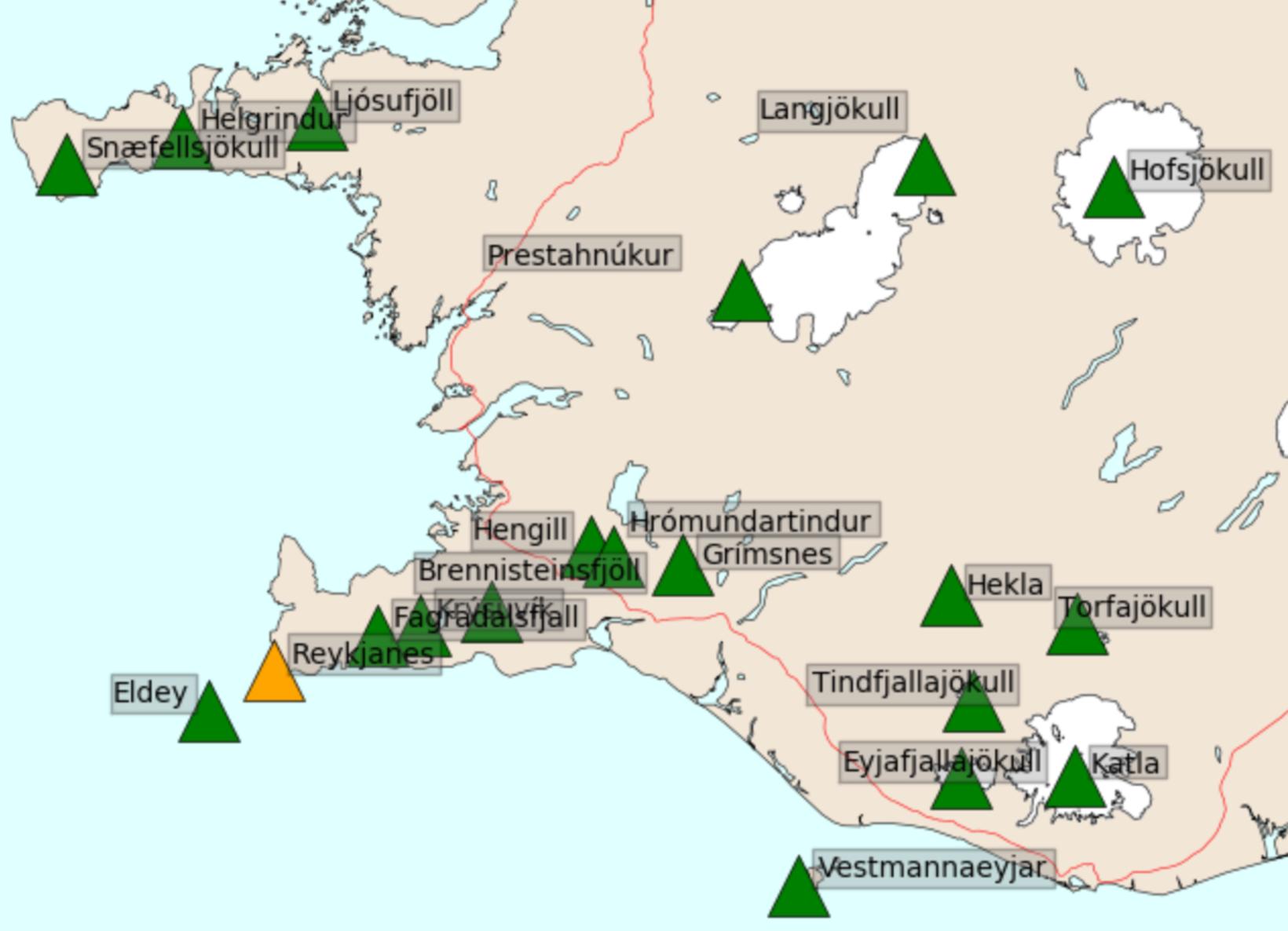
The alert level has been raised to orange. Map/Icelandic Met Office
Air colour alert now orange
The air-colour alert code of the Meteorological Office, for the volcanic system in the north of Reykjanes peninsula, has now been upgraded to orange. It used to be yellow.
The following explanation is given for orange colour alert: "The volcano shows increased activity and a growing likelihood of a volcanic eruption, or, a volcanic eruption is underway, although with little or no ash production.
Yellow means the following: The fireplace shows signs of activity, exceeding the normal condition or, after activity has been reduced from a higher level: The metabolism has decreased significantly but is closely monitored, if it might increase again.
Provides information about the condition of volcanoes
The website of the Meteorological Office states that the flight-code system is in accordance with recommendations from the International Civil Aviation Organisation (ICAO) and gives information about the situation of volcanoes to pilots, the public and the civil aviation authorities.
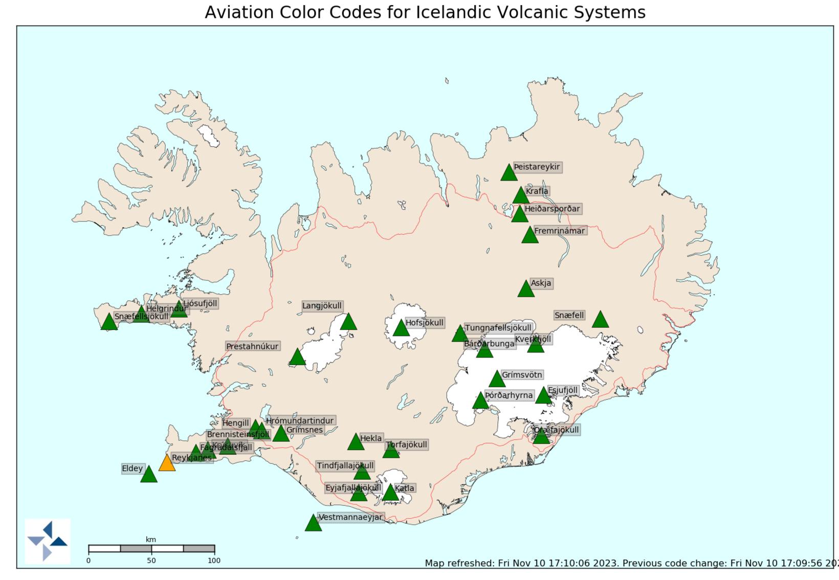
The chart for the whole of the country showing the alert codes for air traffic. Map/Icelandic Met Office
Two strong earthquakes
A strong earthquake occurred at 16.51 today and was felt in many parts of the southwest corner of Iceland. Another earthquake hit shortly afterwards, at 16.56.
The Met Office measurements indicate that the first one was recorded in Stóra-Skógafell in the south. It was 3.8 in size.
The second one appears to have been northeast of Grindavík and south of the Sundhnúkar crater row, but the day's seismic activity has been almost entirely in this area.
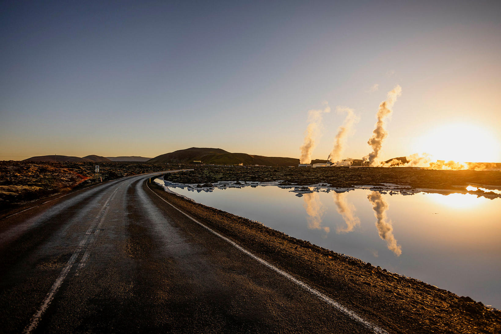
Svartsengi powerplant in the distance. mbl.is/Arnþór Birkisson
Increased power in the seismic swarm
The magnitude of both earthquakes will probably be greater when scientists have finished their overall calculations.
T seismic swarm has been gaining momentum in the last few hours and a number of tremors have been measured of magnitude 3 and above.


/frimg/1/38/77/1387784.jpg)