4.5 size earthquake north of Grindavík
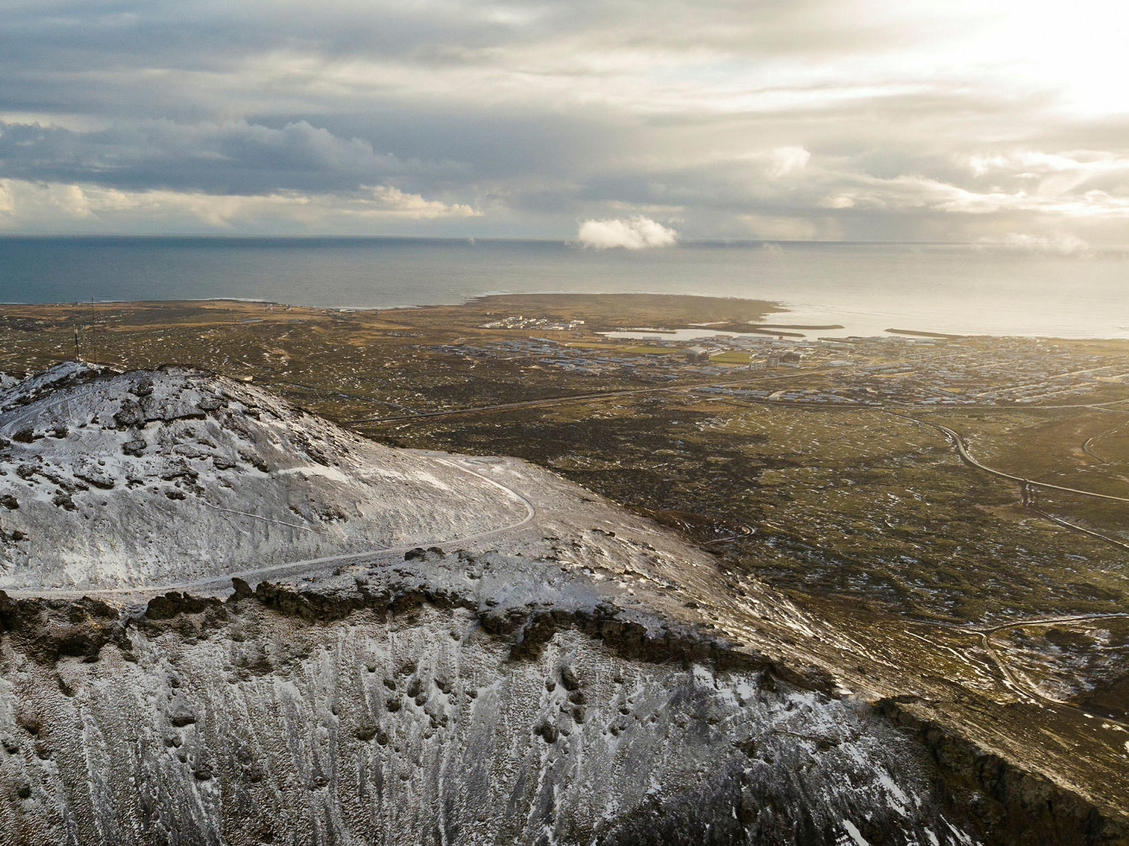
The mountain Þorbjörn by Grindavík. mbl.is/Kristinn Magnússon
An earthquake measuring 4.5 magnitude struck 4 km north of Grindavík at 8.18 this morning. It was felt in Grindavík and all of the Suðurnes area in the Reykjanes peninsula but also in the capital area. When the earthquake hit it was immediately perceived to be over 4 in magnitude by specialists.
The earthquake follows another earthquake of magnitude 3.9 that hit a similar area around 5:30 this morning. A seismic swarm started in this area after midnight both near Þorbjörn mountain and Fagradalsfjall mountain.
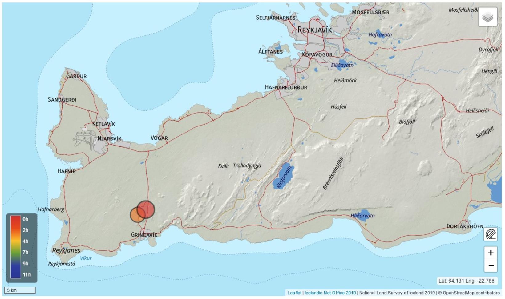
The map shows the location of the two biggest earthquakes this morning. Map/The Icelandic Met Office
According to Einar Bessi Gestsson, a natural hazard specialist at the Icelandic Met Office, the final magnitude of the earthquake was measured at 4.5 magnitude.
700 earthquakes since midnight
Since last night, the Icelandic Met Office’s automatic system has detected about 700 earthquakes on the Reykjanes peninsula. Most of them have occurred north of Grindavík and near Fagradalsfjall.
“There is still considerable small earthquake activity in the area and it is not impossible that tremors of similar magnitude as this morning will occur again. Last time tremors of similar magnitude were measured on the Reykjanes peninsula in July of this year,” says in an announcement from the Icelandic Met Office.


/frimg/1/57/87/1578747.jpg)