The cold in the northern hemisphere captured on satellite
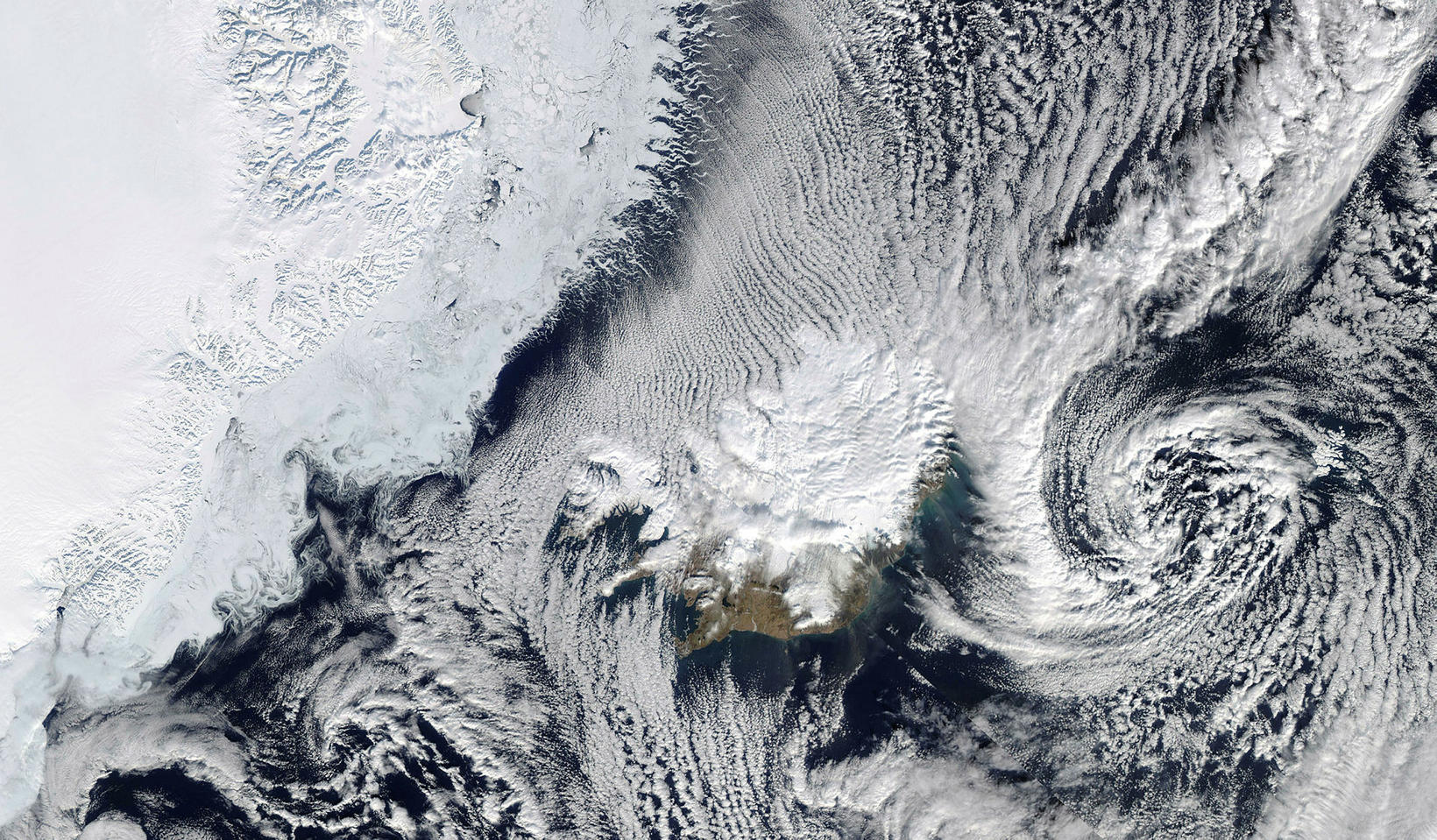
photo/MODIS NASA WorldView
This is what Iceland and its immediate neighbourhood in the northern hemisphere looked like when one of NASA’s satellites, the US space agency, swung over the country earlier this week.
Arctic ice is not far from the West Fjords and the north and east are covered with snow whereas the southwest is snowy. A distinctive pattern of clouds is the cold and dry air that comes off the ice and over warmer water.
The east coastal plain is clearly visible in the image and sandy storm off the south coast.
Due to recent freezing cold, thick ice plates have formed in many parts of the interior, obstructing marinas.
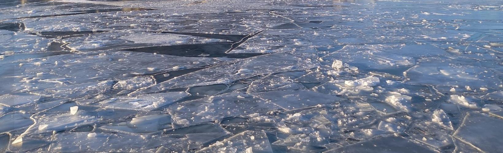
In Hafnarfjörður the marina was frozen yesterday and authorities could not break the ice for a boat that wanted to go out because of the low level of the sea yesterday.
In the Westfjords there have been problems with ice in the fjords near Flateyri and in Bolungarvík. This morning the marina authorities of Ísafjörður went to Bolungarvík to break the ice so the ships could get out to sea. A long stretch of frost and low winds have caused the thick ice formation in the marinas.


/frimg/1/57/93/1579337.jpg)
/frimg/1/57/94/1579405.jpg)