News
| Iceland Monitor
| Fri 24 Jan 2020
| 10.46 GMT
| Modified
at
11.06
Two Earthquakes on Reykjanes Ridge Overnight
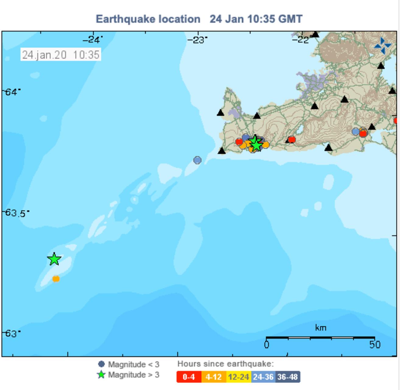
Earthquake map, Jan. 24, 2020. Map/The Icelandic Met Office
Two earthquakes of magnitude more than 3 shook the Reykjanes ridge around 5 am this morning. They both measured 3.3, according to the Icelandic Met Office. Their source of one of them was 26.5 km Southwest of Eldeyjarboði, and of the other one 32.6 km south-southwest of Eldeyjarboði.
On Wednesday afternoon this week, three earthquakes in excess of magnitude 3 hit the Reykjanes ridge as well. They measured 3.6, 3.7 and 3.2. Their source was 5.2 km, 5.4 km and 4.1 km northeast of Grindavík.
On the map above, all recent earthquakes in excess of magnitude 3 are marked with a green star.