Earth Trembles in Southwest Iceland
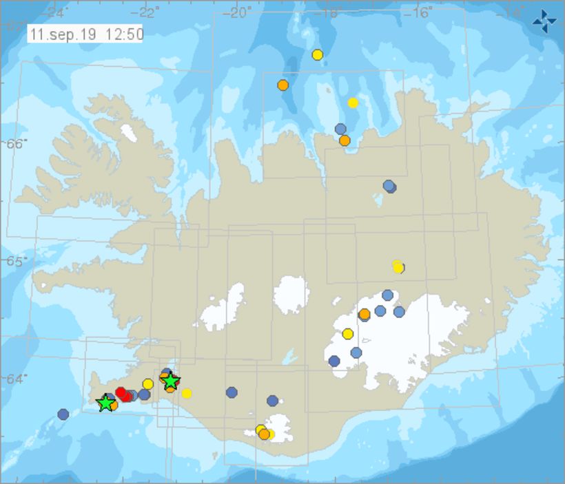
The green stars denote a quake of magnitude 3 or more. The dots indicate tremors, color-coded, according to how long ago they occurred. Map/The Icelandic Met Office
An earthquake of magnitude 3.4 was detected at 6:06 this morning, about 3 km (1.9 miles) northeast of Grindavík, Southwest Iceland, mbl.is reports. Its source was at a depth of 3 km.
According to the Icelandic Met Office, several reports were received from people who detected the quake. Sigríður Magnea Óskarsdóttir, seismologist at the Icelandic Met Office, tells mbl.is that the Met Office monitors the area closely and that earthquakes are common in this area.
The quake was followed by a few smaller aftershocks. Then, shortly before 10 am, a tremor of 3.0 was reported near Hveragerði, also in Southwest Iceland. Its source was at a depth of 5.5 km (3.4 mi). This one, too, was followed by several small tremors.


/frimg/1/57/87/1578747.jpg)