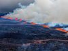
Still taking children to the volcano
mbl.is/Kristinn Magnússon
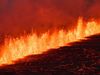
There are examples of people taking their children to the eruption site in Meradalir in spite of it being closed says Bogi Adolfsson who is in Þorbjörn Rescue team to mbl.is. The walk to the volcano and back is 14 km with elevation and through rough terrain, which people should keep in mind.
Yesterday the eruption site was closed due to the weather but it does not stop some people from going. "There are always some people who go, but it wasn't in a group or anything like that," says a rescuer about the situation yesterday.
The eruption site was opened again this morning.
Try to be on top of things but cannot monitor everything
Rescuers try their utmost to make sure that people do not go too close to the volcano, but Adolfsson says they cannot monitor everything that is going on.
He adds that there have bee a lot of people with children in the past days and yesterday some people tried to go to the volcano.
– Do these people not know that the eruption site is closed?
"Yes, they do know it is closed. I can understand the attraction but people need to know that this is a 14 km walk," he adds.
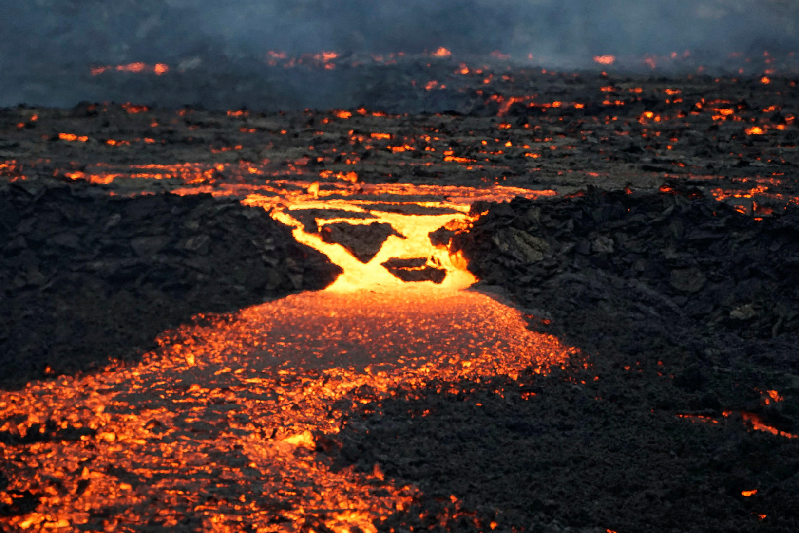
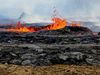
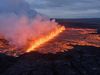
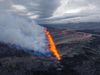
Lava is spreading in Meradalir. mbl.is/Hákon
Stay safe and know what to bring
On the website safetravel.is there are a lot of information for people travelling in Iceland, and a special information page about how to prepare for the walk to Meradalir. Here are some of the main points:
"The hike to the new eruption site is a minimum of 14 km (approximately 9 miles) back and forth with an incline of about 300 meters (0,2 miles). The route is on very hard and slippery terrain and up very steep hills close to the crater. The hike itself can take around 4-5 hours at least.
There is no infrastructure on the hiking trail – no toilets!
What equipment should I bring on the hike to the volcano?
- Backpack
- Headlight/Flashlight with extra batteries
- Hiking boots (waterproof is recommended)
- Hiking poles-not essential but good to have
- Fully charged phone
- GPS if you have one.
- Water bottle
- Hot water, coffee, tea or chocolate in case you get cold.
- Food for more time than you anticipate for the journey.
- Trash bag, don´t leave your trash on-site or on the journey.
What clothing should I wear while hiking?
- Base Layer (wool or synthetic, NOT COTTON)
- Mid layer (wool, fleece, down or synthetic, NOT COTTON)
- The outer layer (waterproof, best if it has fabric that breaths well)
- Extra clothing
- Warm socks, Wool or similar, not Cotton
- Gloves/mittens
- Warm hat
Possible dangers of visiting the eruption site.
Volcanic eruption in Fagradalsfjall mountain is literally the hottest place in Iceland right now. It is really important to keep in mind that in the area and the area close by the volcano the conditions can change really fast. The things that can be dangerous around the eruption are:
- Constant gas pollution the threat of gas pollution increases when the wind drops down, the gas can also gather together where the land is lower than other land and that can be lethal
- New volcanic fissures can open with short or no notice in the area.
- Melting lava can fall from the edge of the lava field and stream fast into new places and it is hard to run from them.
- Lava Field from the 2021 eruption is strictly forbidden to walk on the lava from the eruption last year the crust is thin and underneath is really hot lava which can be extremely dangerous.
- Weather it is really important to have a look at the weather forecast for the day of the hike to see if conditions are suitable for hiking. It is a long and demanding hike towards the volcano and the weather can change really fast, here is the latest weather forecast.
To keep in mind when visiting the site of the eruption
- Children under 12 years old are not allowed on the eruption site or the trail.
- The best way to the eruption site depends on the wind direction and weather each time so please follow the recommendations of the police and search and rescue teams.
- The hike to the new eruption site is a minimum of 7 km (approximately 4,5 miles) one way with an incline of about 300 meters (0,2 miles) so the route there and back is about 14 km (9 miles). The route is on very hard terrain and up very steep hills close to the crater. The hike itself can take around 4-5 hours at least.
- The hike to the vantage point where the crater is visible is about 5 km (3 miles) one way, it is best to park your car at parking lot #1 and hike route A and continue over the terrain, towards the new eruption site.
- Leave your car in a marked parking lot, not on the side of the road, there is enough parking for everyone.
- Driving outside marked trails is forbidden.
- Follow instructions from the local authorities and the ICE-SAR members on site. The area could be closed with short notice."