Largest Earthquake in Húsafell Area in Decades
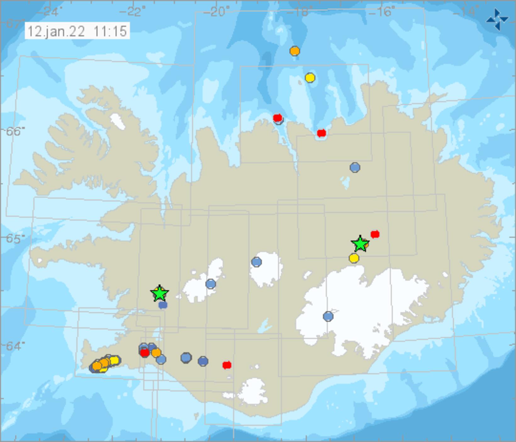
The green stars show the location of Húsafell (in the west) and Askja (north of Vatnajökull glacier). Map/Icelandic Met Office
Shortly before 9 am yesterday, an earthquake of magnitude 3.1 hit near Húsafell, West Iceland. It is the largest earthquake to hit the area since 1994, according to Kristín Jónsdóttir, earthquake hazards coordinator at the Icelandic Met Office. Its source was at a depth of 4.0 km, 18.1 km southwest of Húsafell. To see its location, click here.
“We’ve been seeing tiny swarms [of tremors] in this area,” states Bryndís Ýr Gísladóttir, natural hazards specialist at the Icelandic Met Office, and adds that more than 70 tremors have registered there since January 9.
On her Twitter page, Kristín brings attention to yesterday’s earthquake in the post below.
At present, unusual trembling is not limited to West Iceland alone. Overnight, four tremors registered in Askja volcano, located north of Vatnajökull glacier, the largest of which measured 3.1 in magnitude. It hit at 4:30 am.
Bjarki Kaldalóns Friis, natural hazards specialist at the Icelandic Met Office, tells mbl.is that the tremors are likely part of the inflation which has been taking place in Askja since August.
“The inflation had slowed down before Christmas, and equipment was installed by Askja around December 20,” Bjarki notes. “We don’t see clearly whether the inflation is continuing, but it likely is.”
He adds that tremors are not unusual in Askja, “but it is somewhat unusual for a tremor of magnitude 3.1 to hit.”
The Icelandic Met Office continues monitoring the area.
You can read all about Askja here.
Related news:


/frimg/1/57/87/1578747.jpg)