Even worse weather to hit Iceland over next few days
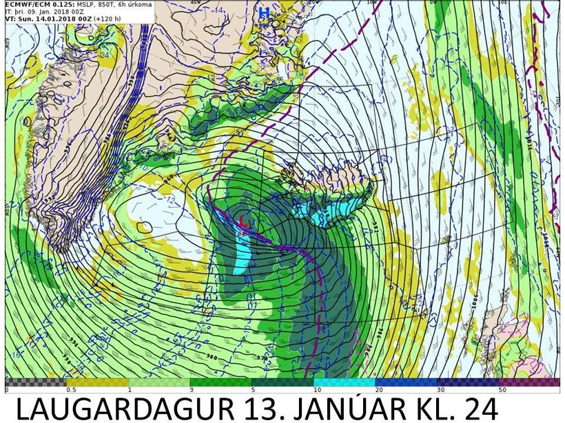
The worst storm will probably hit Iceland on Saturday evening. Mynd/Evrópska reiknimiðstöðin
According to meterologist Einar Sveinbjörnsson a series of lows are to be expected which means that the weather could become even worse than the weather experienced in Reykjavik this morning.
"We are in the deepest path of winter lows over the next few days," he says speaking to mbl.is. "There's uncertainty in the weather forecasts as to at when and at what time they will arrive. There are three or even four areas of low pressure coming up towards Iceland in the South East and South."
Sveinbjörnsson is particularly wary about the weather forecast on Saturday night when wind speeds are expected at between 23- 28 metres per second in most parts of the country.

Meterologist Einar Sveinbjörnsson
Þá er einnig gert ráð fyrir djúpri og krappri lægð suðvestan úr höfum á fimmtudagskvöld, sem mun gera feikna storm úr suðaustri ef spáin gengur eftir. Kjöraðstæður eru fyrir myndun öflugra lægða um þessar mundir, að sögn Einars. Another bad storm could be occuring on Thursday night from the South East. "Cold air from North America streams into the Atlantic ocean meeting with warmer air from the south, near the coast of Canada and Newfoundland creating prime conditions for these areas of deep pressure."
So all in all, we would recommend to our readers visiting or living in Iceland to watch the weather forecast very closely over the next few days.


/frimg/1/38/77/1387784.jpg)