Anvil cloud formation likely today
Readers are encouraged to keep their eyes peeled and their cameras handy today as prevailing weather conditions could fashion ‘anvil clouds’ of the type shown in the picture above.
A light southerly wind and intermittent snow fall in southern and western parts of Iceland today increase the likelihood of seeing anvil clouds (cumulonimbus incus).
Anvil clouds are flat-topped storm clouds typically reaching over 10,000 m in altitude, and are often associated with stormy conditions and weather hazards.
Indeed, forecasts indicate an approaching depression from the south, dragging a northerly wind over Iceland and bringing more snow and stormy conditions over the next few days.
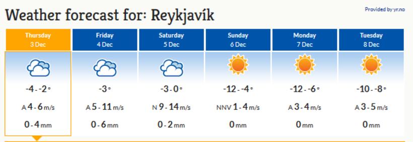
Freezing temperatures are the order of the day for the foreseeable future, as the six-day forecast for Reykjavik below shows.
You can check out the weather in your part of Iceland on Iceland Monitor here.


