Holuhraun seen from a drone
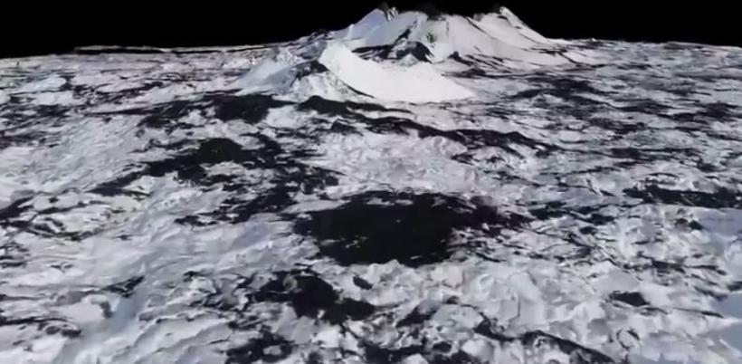
3D images of Holuhraun taken by a drone. Screenshot
Two weeks after the eruption at Holuhraun ended, Icelandic company Svarmi along with the University of Iceland institute of Earth Sciences captured images of the new lava field using a specially made drone. The drone mapped out the lava field, captured high resolution aerial images and made a 3D model of it.
"Conditions in the area are particularly difficult for drones. Landing on lava is extremely difficult and automatic landing virtually impossible," explains Tryggvi Stefánsson, one of the founders of Svarmi. Steam jets rising from the lava made filming difficult. Stefánsson explains that the drone flew over the area eight times and mapped out several square kilometres.
"This is the first time that this has been done in Iceland, using a drone to map out a new lava field and make a 3D model. The model is very useful for geoscientists who would otherwise need to walk across the area with a GPS device.
Even the smallest changes in the lava are detected, something which previously was not possible.
Here's a look at the Holuhraun lava as you've never seen it before: