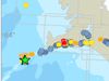
New danger assessment – continuing lava accumulation
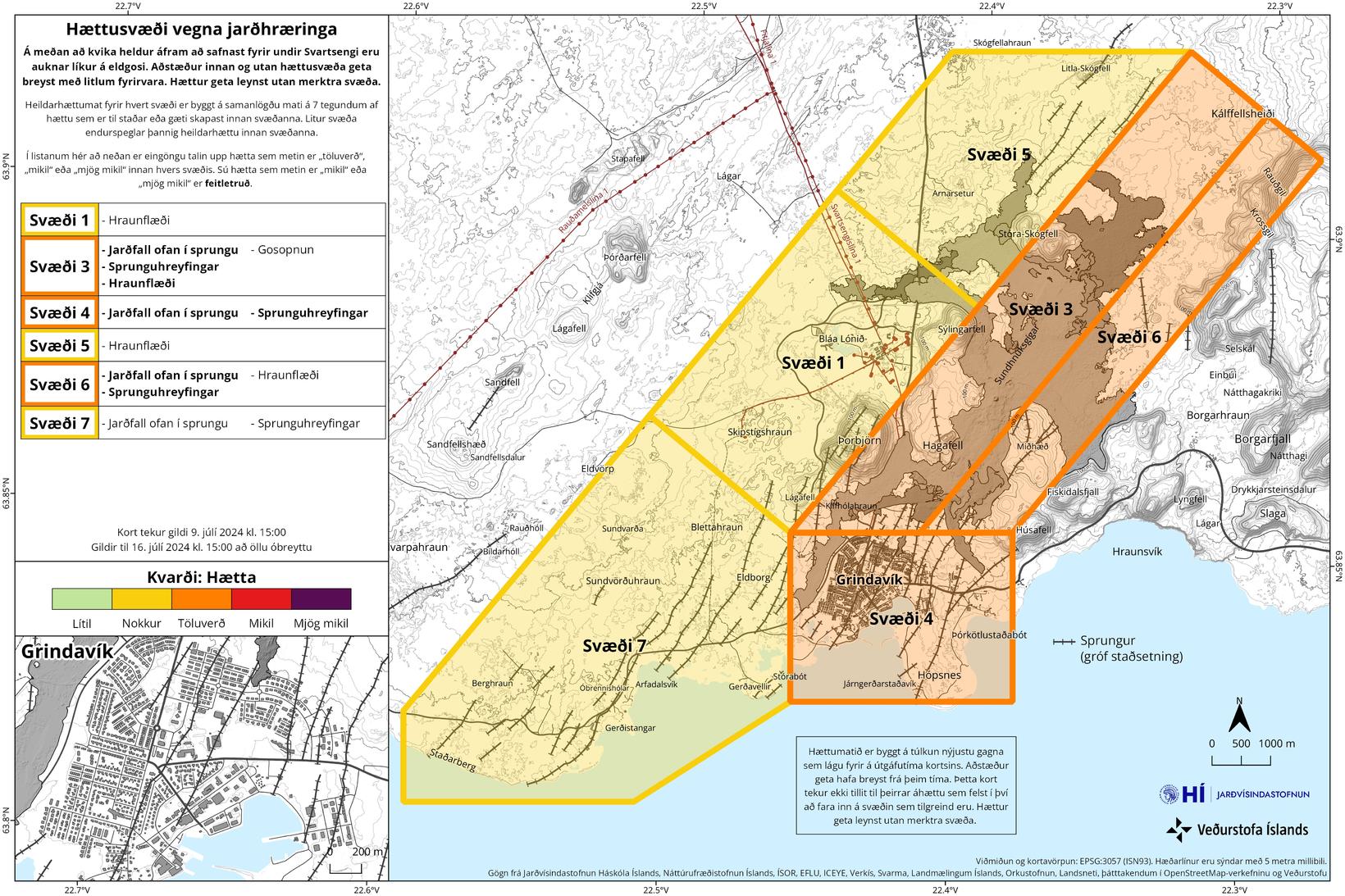
The danger assessment today is similar to the previous one. Map/The Icelandic Met Office
Inflation under Svartsengi is continuing and has been at a similar rate in the last few days. A satellite image from Sentinel 1 from June 25 to July 7 shows the same pattern. Model calculations indicate that magma flow is higher now than before the eruption on May 29. This data indicates that another magma outburst and/or eruption is likely in the coming weeks or months.
The hazard assessment has been updated and remains virtually unchanged, but the risk due to lava flows at Svartsengi has decreased. The risk is therefore reduced from considerable risk (orange) to quite a risk (yellow). The hazard assessment is valid until July 16, if nothing changes.
This is stated in an announcement from the Icelandic Met Office.
20 earthquakes over the magma channel
Almost 20 earthquakes have been measured over the magma channel in the past week. The largest one measured 1.3 magnitude west of Grindavík town. The activity is similar to the last two weeks.
More than 260 earthquakes have been measured on the Reykjanes peninsula in the past week, including 60 in Lambafell in Þrengsli, and about a dozen in Brennisteinsfjöll mountains. More than 100 earthquakes were measured around Kleifarvatn lake. Almost 40 earthquakes were measured in Mt Fagradalsfjall, all under 1 in size and most were at a depth of 7 to 10 km. About 20 earthquakes were measured outside of Reykjanestá, the uttermost tip of Reykjanes peninsula, in the past week and another dozen further out on Reykjanes Ridge, about 90 km southwest of Iceland, the announcement states.