News
| Iceland Monitor
| Sat 30 Dec 2023
| 11.47 GMT
New hazard assessment map issued: Increased danger of eruption
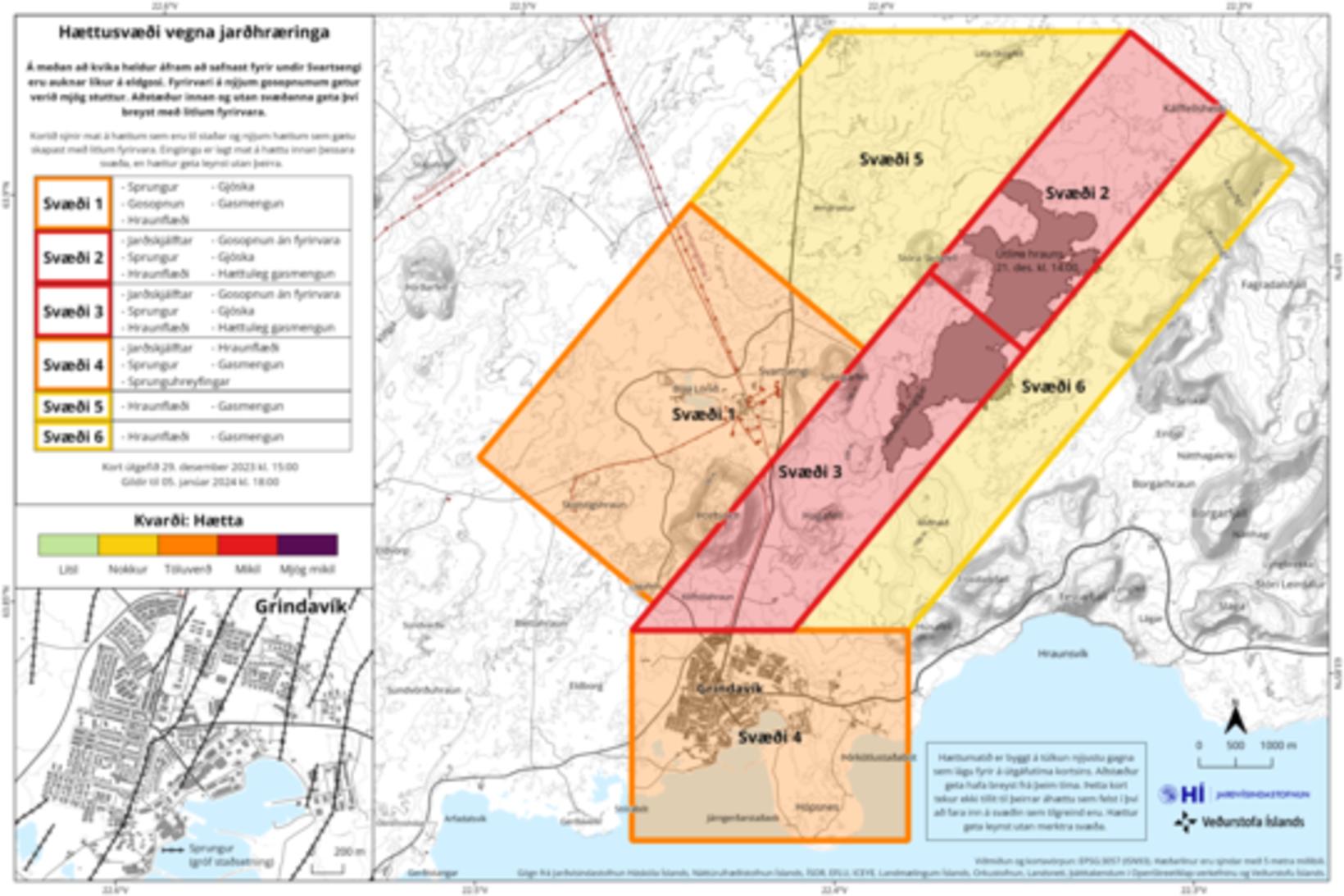
The new hazard assessment map is issued until January 5. Map/Icelandic Met Office
The dangers of possible lava flow and gas pollution have been added to the hazard assessment map issued by the Icelandic Met Office yesterday. The map will be valid until January 5, 2018.
The reason for the changes is increased likelihood of a volcanic eruption north of Grindavík, as stated in a notice from the Icelandic Met Office.
The changes cover the area number 4 on the map.
The Icelandic Met Office confirms that the last eruption, on December 18, began with very short notice.
The Icelandic Met Office continues to monitor the area with care and is in direct contact with civil protection about the situation.