Decrease in earthquakes but land continues to rise
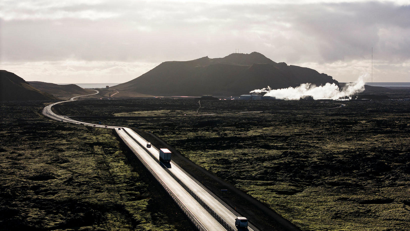
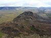
A view to the south from Grindavíkurvegur road. The smoke is coming from the Svartsengi powerplant going west. In the background in Mt. Þorbjörn. mbl.is/Hákon
The seismic activity on the Reykjanes peninsula has decreased markedly since 17.30 yesterday, but the land rise has continued. A total of 900 earthquakes have been registered in the past twelve hours.
This is stated in an announcement from the Icelandic Met Office.
“The seismic activity has therefore decreased significantly since yesterday morning, but the development of the activity, both in terms of size, number and location of earthquakes, is comparable to the development that has been seen before in connection with magma accumulation in the vicinity of Þorbjörn mountain,” the announcement states.
Seismic activity will vary
Lovísa Mjöll Gudmundsson, a natural hazard specialist at the Icelandic Met Office, tells us this means that the seismic activity follows the pattern that has been observed before with magma accumulation in the vicinity of Þorbjörn mountain. It is expected that the seismic activity will vary. She says that magma accumulation has occurred in the vicinity of Þorbjörn mountain five times before in recent years and this is not unlike those cases.
Activity after midnight has been mainly at the Sandhnúkar crater row northeast of Mt. Þorbjörn and also west of Eldvörp. Based on the latest deformation data, the land rising continues and is thought to be due to magma accumulation at a depth of about 4-5 kilometers northwest of Mt. Þorbjörn.
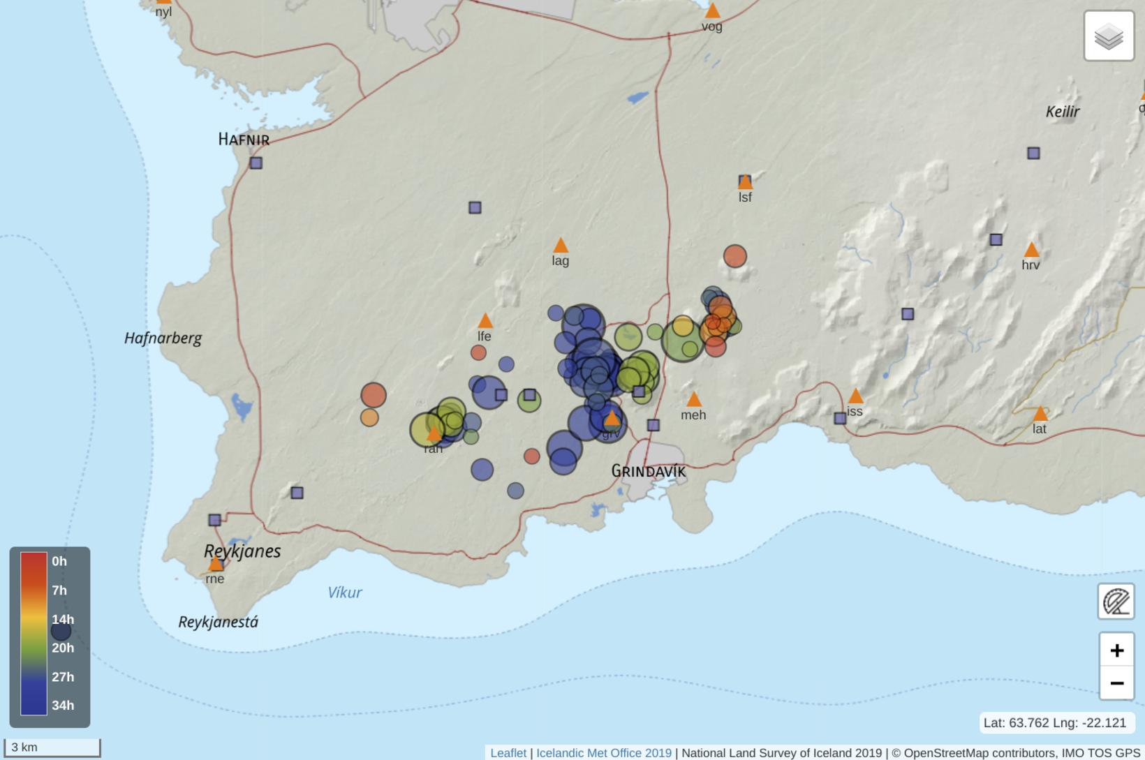
Earthquakes (circles) over 1.5 in size since midnight November 3 until 10.45 am November 4. The colour code to the left shows what time the earthquakes occurred and the size of the cirles implicates the magnitude.The location of seismometers (triangles) and GPS (boxes) are also shown. Computer drawn image/The Icelandic Met Office
Yesterday's tremors were triggered earthquakes
The announcement states that close monitoring is being carried out to see if seismic activity is decreasing, but this would be a sign that magma is breaking its way to the surface. Simultaneously, a sudden expansion of the surface should be measured on GPS meters along with increasing disturbances, which are extremely frequent, and small earthquakes. No clear signs of this are visible, but the axis of events can change with little notice, the announcement states.
“In the area around Mt. Þorbjörn, west and east of the mountain, and in fact along the entire techtonic plates, there are fissures that head south-north and connect to the tectonic plate drift. They can then deform due to stress from magma activity and this is what we have seen from the beginning of the events that started with Fagradalsfjall in 2021. Yesterday’s larger earthquakes at Mt. Þorbjörn occurred on such fissures and at that voltage release, the stress can shift to other nearby fissures,” the announcement quotes Benedikt Halldórsson, the director of earthquake risk at the Icelandic Met Office.
“That’s the trend we seem to be seeing now regarding the seismic activity yesterday and last night. The earthquakes to the east and west of Mt. Þorbjörn’s magma deposit are what we’ve called triggered quakes and are a reaction to the tension caused by the magma accumulation,” he concluded.


/frimg/1/58/37/1583777.jpg)