Severe Gale Forecast in Iceland
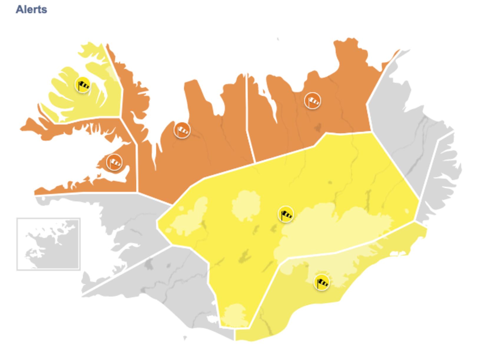
Map/Icelandic Met Office
The Icelandic Met Office has issued weather alerts for a large part of Iceland today. The warnings include all the northern half of the country, the highlands and Southeast Iceland.
The worst weather – an orange weather alert – is expected around Breiðafjörður bay in West Iceland (between 1 and 5 pm), in Northwest Iceland (between 11 am today and 7 am tomorrow) to be followed by a southwesterly gale or severe gale into tomorrow afternoon, and in Northeast Iceland (between 5 pm today and 7 am tomorrow).
In those areas, a southern and southwestern severe gale or storm is expected with sustained wind speeds of up to 28 m/s (100 km/h). Dangerous and violent wind gust can be expected near mountains, which may locally exceed 40 m/s (140 km/h).
Travelers using campers or RVs should not travel during this time, tents can be damaged and hikers should seek shelter indoors. The Met Office advices residents to secure trampolines and garden furniture and to exercise caution.
A southwesterly gale or severe gale will follow around Breiðafjörður bay (from 5 pm until midnight). Similar weather is currently in the West Fjords, in Northwest Iceland and in Northeast Iceland.
In Southeast Iceland and in the central highlands, there is currently a southwesterly gale or severe gale, expected to continue until late afternoon or early evening tomorrow. Traveling can be hazardous in the highlands. Due to rapid warming in the central highlands, rivers are expected to swell, making them difficult to cross.
For more detailed information, please visit vedur.is.