Huge storm hits South Iceland: Orange and yellow alert put up
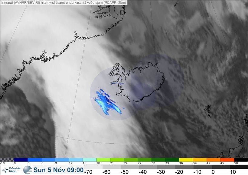
An image showing the storm approching the country. image/Iceland Met Office
A deep low is approaching Iceland accompanied with a southeasterly storm. Windspeeds are expected between18-25 m/s and gusts up to 40 m/s. Roads from Reykjavik will be affected, with strong gusts near mountains. People are also advised to secure loose things.
The Department of Civil Protection and Emergency management has put up an orange alert for Reykjavik and South Iceland and a yellow alert for the west fjords, North Iceland and East Iceland.
Disruption in transportation is to be expected throughout the country and hazardous travelling conditions can be expected, especially near Eyjafjöll and on mountain roads. Severe rain or sleet can also be expected.
The Reykjavik Metropolitan Police, SAR teams and the fire department are all preparing for when the storm hits to aid anyone affected.
The worst of the weather will hit Reykjavik between 5 and 6 pm today.

The Department of Civil Protection and Emergency management has put up an orange alert for Reykjavik and South Iceland. mbl.is/Júlíus